Map Projected Browse Image
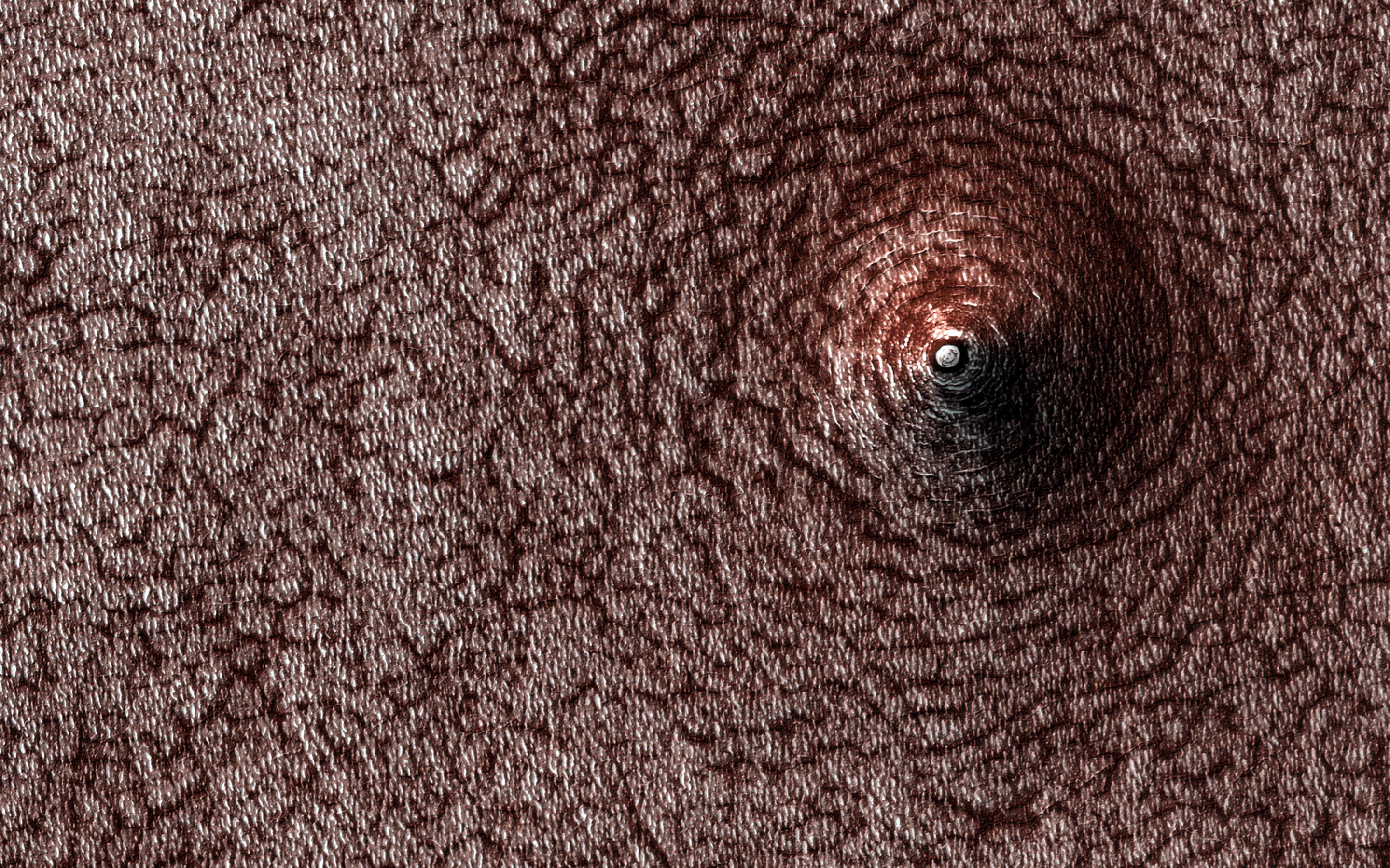
Click on image for larger versionDo you see a dome or a pit? Sometimes it is hard to tell! In this case, the answer is that we're looking at a pit, if the title didn't already give it away.
Levity aside, we can tell this is a pit because we know what direction the sunlight is coming from and which side should be in shadow. This pit has formed on the south polar layered deposits. Why did it collapse? That is the real question to be answered.
The map is projected here at a scale of 50 centimeters (19.7 inches) per pixel. (The original image scale is 49.6 centimeters [19.5 inches] per pixel [with 2 x 2 binning]; objects on the order of 149 centimeters [58.7 inches] across are resolved.) North is up.
The University of Arizona, in Tucson, operates HiRISE, which was built by Ball Aerospace & Technologies Corp., in Boulder, Colorado. NASA's Jet Propulsion Laboratory, a division of Caltech in Pasadena, California, manages the Mars Reconnaissance Orbiter Project for NASA's Science Mission Directorate, Washington.

