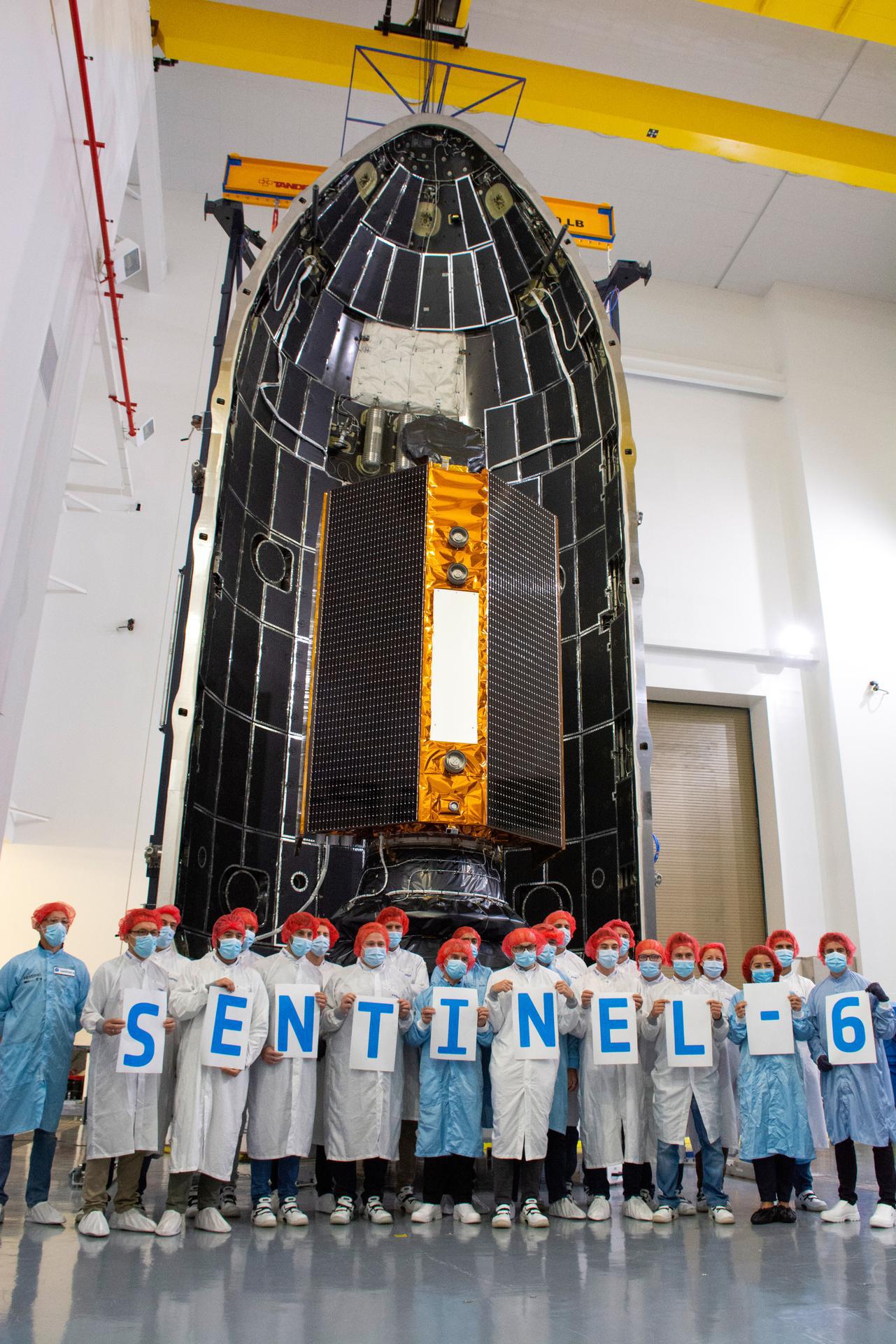
Technicians and engineers working on the Sentinel-6 Michael Freilich satellite pose in front of the spacecraft as it sits in a protective nosecone, or payload fairing, in the SpaceX Payload Processing Facility at Vandenberg Air Force Base in California. Once it's closed up, the fairing will sit atop a SpaceX Falcon 9 rocket when it launches from Vandenburg Air Force Base in central California in late November 2020.
Sentinel-6 Michael Freilich is one of two identical satellites that are a part of the Sentinel-6/Jason-CS (Continuity of Service) mission, a U.S.-European collaboration. The mission is part of Copernicus, the European Union's Earth observation program managed by the European Commission. Continuing the legacy of the Jason series missions, Sentinel-6/Jason-CS will extend the records of sea level into their fourth decade, collecting accurate measurements of sea surface height for more than 90% of the world's oceans, and providing crucial information for operational oceanography, marine meteorology, and climate studies. Sentinel-6 Michael Freilich's twin, Sentinel-6B, is scheduled to launch in 2025.
Sentinel-6/Jason-CS is being jointly developed by ESA (European Space Agency), the European Organisation for the Exploitation of Meteorological Satellites (EUMETSAT), NASA, and the National Oceanic and Atmospheric Administration, with funding support from the European Commission and technical support from France's National Centre for Space Studies.
JPL, a division of Caltech in Pasadena, is contributing three science instruments for each Sentinel-6 satellite: the Advanced Microwave Radiometer, the Global Navigation Satellite System — Radio Occultation, and the Laser Retroreflector Array. NASA is also contributing launch services, ground systems supporting operation of the NASA science instruments, the science data processors for two of these instruments, and support for the U.S. members of the international Ocean Surface Topography Science Team.
 Planetary Data System


