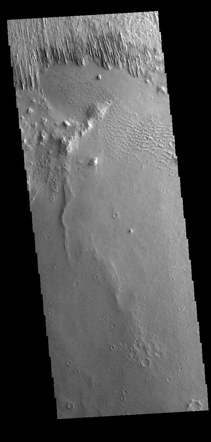
Context imageYardangs are present at the top of this VIS image. These features are created by long term winds scouring a poor cemented surface material into linear ridges and valleys. These yardangs are part of the Medusa Fossae Formation. It has been suggested that this region of Mars provides a large percentage of the surface dust seen around the planet. Ash falls from nearby volcanoes may have been the source of the surface materials eroded into these and other wind eroded landforms.
Orbit Number: 77922 Latitude: -12.7644 Longitude: 177.96 Instrument: VIS Captured: 2019-07-09 09:43
Please see the THEMIS Data Citation Note for details on crediting THEMIS images.
NASA's Jet Propulsion Laboratory manages the 2001 Mars Odyssey mission for NASA's Science Mission Directorate, Washington, D.C. The Thermal Emission Imaging System (THEMIS) was developed by Arizona State University, Tempe, in collaboration with Raytheon Santa Barbara Remote Sensing. The THEMIS investigation is led by Dr. Philip Christensen at Arizona State University. Lockheed Martin Astronautics, Denver, is the prime contractor for the Odyssey project, and developed and built the orbiter. Mission operations are conducted jointly from Lockheed Martin and from JPL, a division of the California Institute of Technology in Pasadena.
