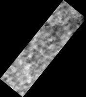
Map Projected Browse Image
Click on image for larger versionWinter on Mars comes with a blanket of carbon dioxide snow. During the spring "thaw," this snow evaporates into the atmosphere, lingering longest in the shallow depressions such as the troughs of polygon patterned ground.
Enhanced color shows the carbon dioxide snow as bluish-white patches among areas of rusty red bare ground. We took this image in 2008 as a possible landing site for the Phoenix Lander that arrived on Mars later that same year.
The map is projected here at a scale of 25 centimeters (9.8 inches) per pixel. [The original image scale is 31.9 centimeters (12.6 inches) per pixel (with 1 x 1 binning); objects on the order of 96 centimeters (37.8 inches) across are resolved.] North is up.
The University of Arizona, Tucson, operates HiRISE, which was built by Ball Aerospace & Technologies Corp., Boulder, Colorado. NASA's Jet Propulsion Laboratory, a division of Caltech in Pasadena, California, manages the Mars Reconnaissance Orbiter Project for NASA's Science Mission Directorate, Washington.

