Map Projected Browse Image
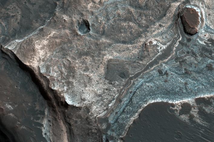
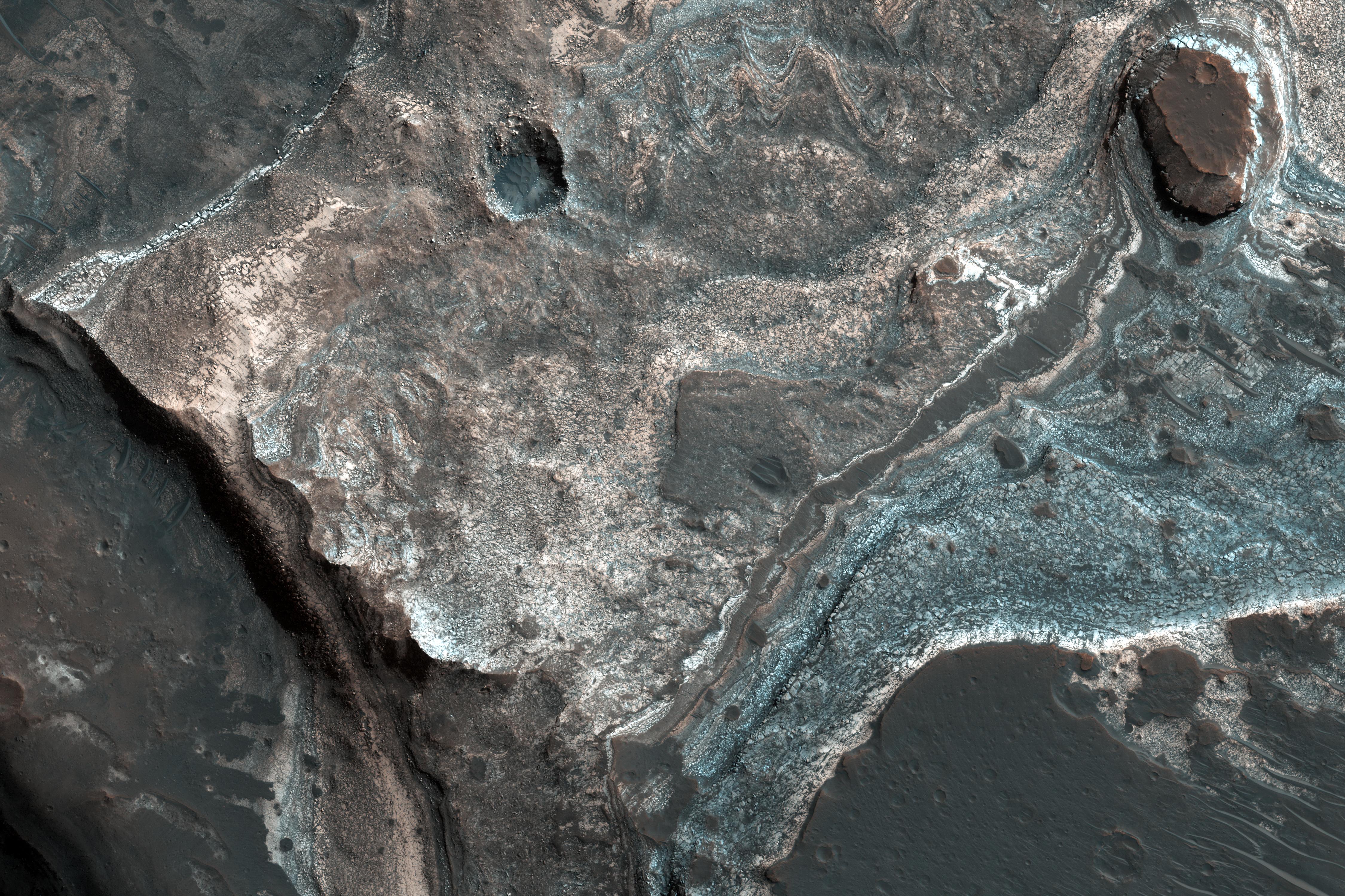
Click on the image for larger versionThis image from NASA's Mars Reconnaissance Orbiter (MRO) shows the western wall of a small pit that is located along the floor of a larger trough in Coprates Catena. Dark layers are exposed along the bottom of the pit wall while light-toned layers are near the top of the pit and the adjacent trough floor.
Based upon where the layers are exposed, we can tell that the dark layers formed first followed by the light layers. The light layers could have been deposited when water filled part of the trough while the dark layers could be older lava flows.
The map is projected here at a scale of 25 centimeters (9.8 inches) per pixel. [The original image scale is 26.1 centimeters (10.3 inches) per pixel (with 1 x 1 binning); objects on the order of 78 centimeters (30.7 inches) across are resolved.] North is up.
This is a stereo pair with PSP_009631_1650.
The University of Arizona, Tucson, operates HiRISE, which was built by Ball Aerospace & Technologies Corp., Boulder, Colorado. NASA's Jet Propulsion Laboratory, a division of Caltech in Pasadena, California, manages the Mars Reconnaissance Orbiter Project for NASA's Science Mission Directorate, Washington.
