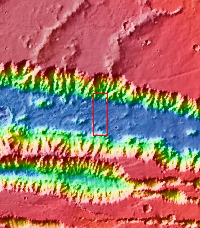
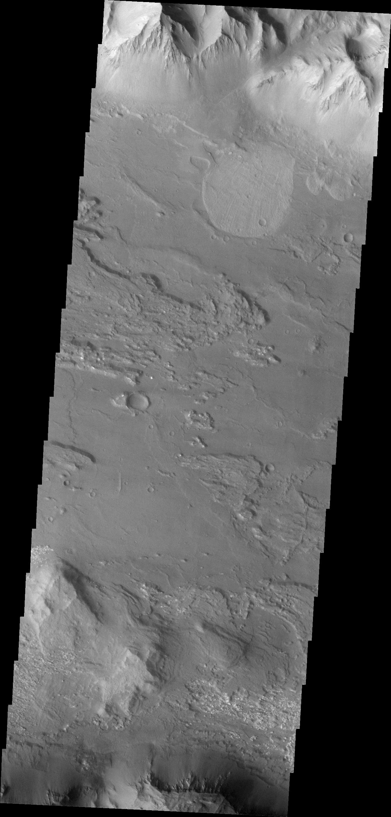
Context image Coprates Chasma is one of the numerous canyons that make up Valles Marineris. The chasma stretches for 960 km (600 miles) from Melas Chasma to the west and Capri Chasma to the east. Landslide deposits, layered materials and sand dunes cover a large portion of the chasma floor. This image is located in central Coprates Chasma. The image shows multiple landslide features, which form the bright lobed shaped deposits at the bottom of the canyon cliff face (top of image). The linear grooves on the top of the large landslide deposit were formed as the material came to rest on the canyon floor. The other features on the chasma floor are layered materials that have been weathered.
The Odyssey spacecraft has spent over 15 years in orbit around Mars, circling the planet more than 69000 times. It holds the record for longest working spacecraft at Mars. THEMIS, the IR/VIS camera system, has collected data for the entire mission and provides images covering all seasons and lighting conditions. Over the years many features of interest have received repeated imaging, building up a suite of images covering the entire feature. From the deepest chasma to the tallest volcano, individual dunes inside craters and dune fields that encircle the north pole, channels carved by water and lava, and a variety of other feature, THEMIS has imaged them all. For the next several months the image of the day will focus on the Tharsis volcanoes, the various chasmata of Valles Marineris, and the major dunes fields. We hope you enjoy these images!
Orbit Number: 16803 Latitude: -12.5614 Longitude: 296.887 Instrument: VIS Captured: 2005-09-27 20:25
Please see the THEMIS Data Citation Note for details on crediting THEMIS images.
NASA's Jet Propulsion Laboratory manages the 2001 Mars Odyssey mission for NASA's Science Mission Directorate, Washington, D.C. The Thermal Emission Imaging System (THEMIS) was developed by Arizona State University, Tempe, in collaboration with Raytheon Santa Barbara Remote Sensing. The THEMIS investigation is led by Dr. Philip Christensen at Arizona State University. Lockheed Martin Astronautics, Denver, is the prime contractor for the Odyssey project, and developed and built the orbiter. Mission operations are conducted jointly from Lockheed Martin and from JPL, a division of the California Institute of Technology in Pasadena.
 Planetary Data System


