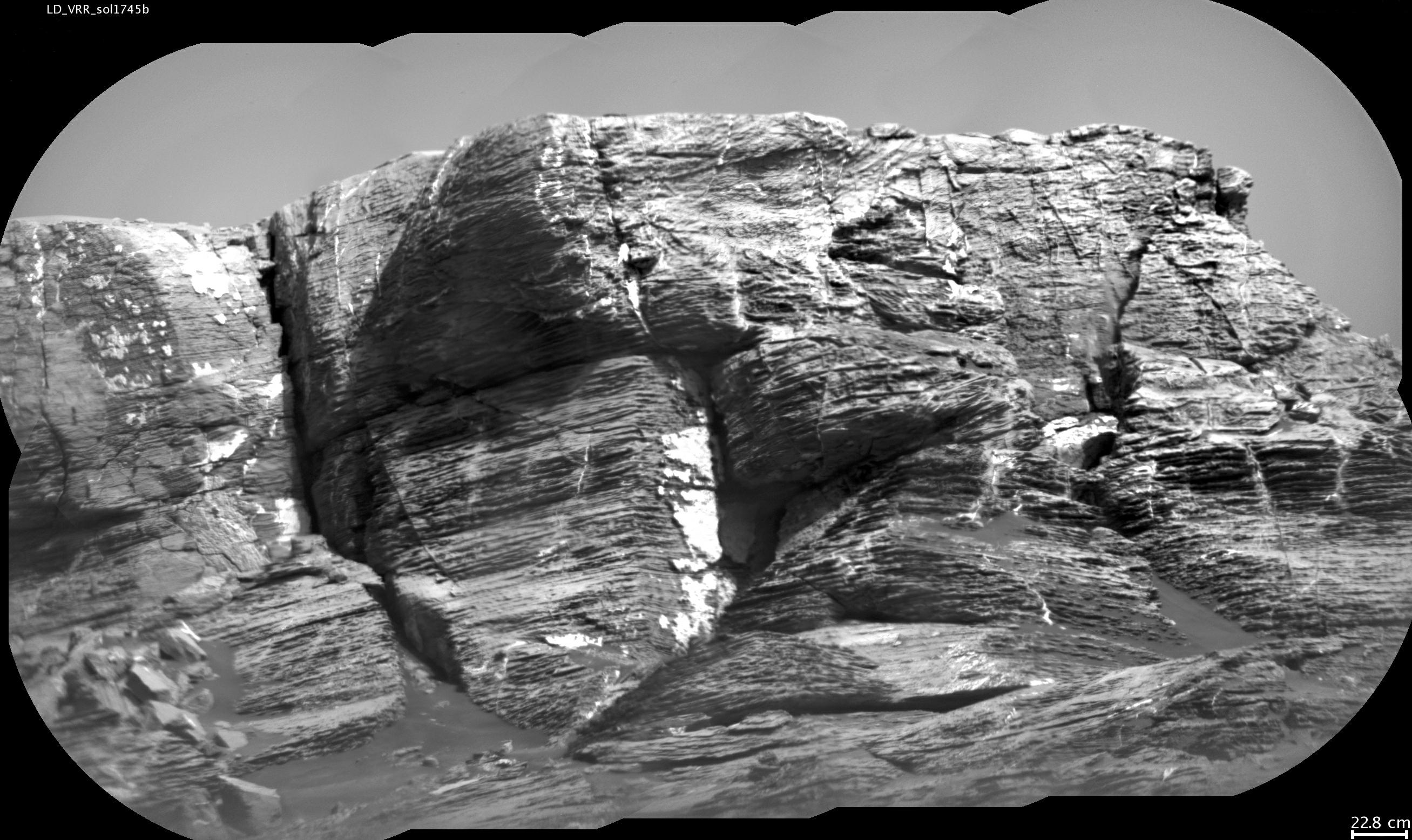
This view of "Vera Rubin Ridge" from the Chemistry and Camera (ChemCam) instrument on NASA's Curiosity Mars rover shows multiple sedimentary layers and fracture-filling deposits of minerals.
Buried layers of what is now a ridge became fractured, and the fractures were filled with mineral deposits precipitated from underground fluids that moved through the fractures.
ChemCam's telescopic Remote Micro-Imager took the 10 component images of this mosaic on July 3, 2017, during the 1,745th Martian day, or sol, of Curiosity's work on Mars. The camera was about 377 feet (115 meters) away from the pictured portion of the ridge. The rover's location at the time, shown in a Sol 1741 traverse map, was west of the place where it began its ascent up the ridge about two months later.
The scale bar at lower right indicates how wide a feature 9 inches (22.8 centimeters) in width would look in the middle portion of the scene.
ChemCam is one of 10 instruments in Curiosity's science payload. The U.S. Department of Energy's Los Alamos National Laboratory, in Los Alamos, New Mexico, developed ChemCam in partnership with scientists and engineers funded by the French national space agency (CNES), the University of Toulouse and the French national research agency (CNRS). More information about ChemCam is available at http://www.msl-chemcam.com/.
