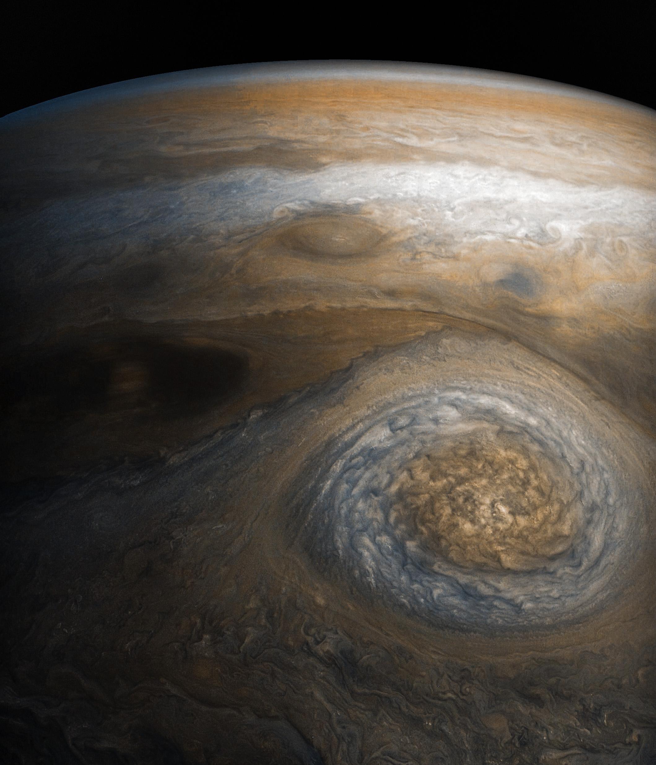
A dynamic storm at the southern edge of Jupiter's northern polar region dominates this Jovian cloudscape, courtesy of NASA's Juno spacecraft.
This storm is a long-lived anticyclonic oval named North North Temperate Little Red Spot 1 (NN-LRS-1); it has been tracked at least since 1993, and may be older still. An anticyclone is a weather phenomenon where winds around the storm flow in the direction opposite to that of the flow around a region of low pressure. It is the third largest anticyclonic oval on the planet, typically around 3,700 miles (6,000 kilometers) long. The color varies between red and off-white (as it is now), but this JunoCam image shows that it still has a pale reddish core within the radius of maximum wind speeds.
Citizen scientists Gerald Eichstädt and Seán Doran processed this image using data from the JunoCam imager. The image has been rotated so that the top of the image is actually the equatorial regions while the bottom of the image is of the northern polar regions of the planet.
The image was taken on July 10, 2017 at 6:42 p.m. PDT (9:42 p.m. EDT), as the Juno spacecraft performed its seventh close flyby of Jupiter. At the time the image was taken, the spacecraft was about 7,111 miles (11,444 kilometers) from the tops of the clouds of the planet at a latitude of 44.5 degrees.
JunoCam's raw images are available at www.missionjuno.swri.edu/junocam for the public to peruse and process into image products.
More information about Juno is online at http://www.nasa.gov/juno and http://missionjuno.swri.edu.
NASA's Jet Propulsion Laboratory manages the Juno mission for the principal investigator, Scott Bolton, of Southwest Research Institute in San Antonio. Juno is part of NASA's New Frontiers Program, which is managed at NASA's Marshall Space Flight Center in Huntsville, Alabama, for NASA's Science Mission Directorate. Lockheed Martin Space Systems, Denver, built the spacecraft. Caltech in Pasadena, California, manages JPL for NASA.
 Planetary Data System


