As summer approaches in Titan's northern hemisphere, NASA's Cassini spacecraft has been monitoring Titan, anticipating an increase in cloud activity at high northern latitudes. Intriguingly, with the summer solstice just a couple of weeks away, an outburst of multiple clouds appeared at mid-northern latitudes.
These are some of the most intensely bright clouds Cassini has observed on Titan, likely due to high-cloud tops. This activity also represents the most extensive cloud outburst on Titan since clouds reappeared at northern mid-latitudes in early 2016.
See PIA21450 for another view of these clouds.
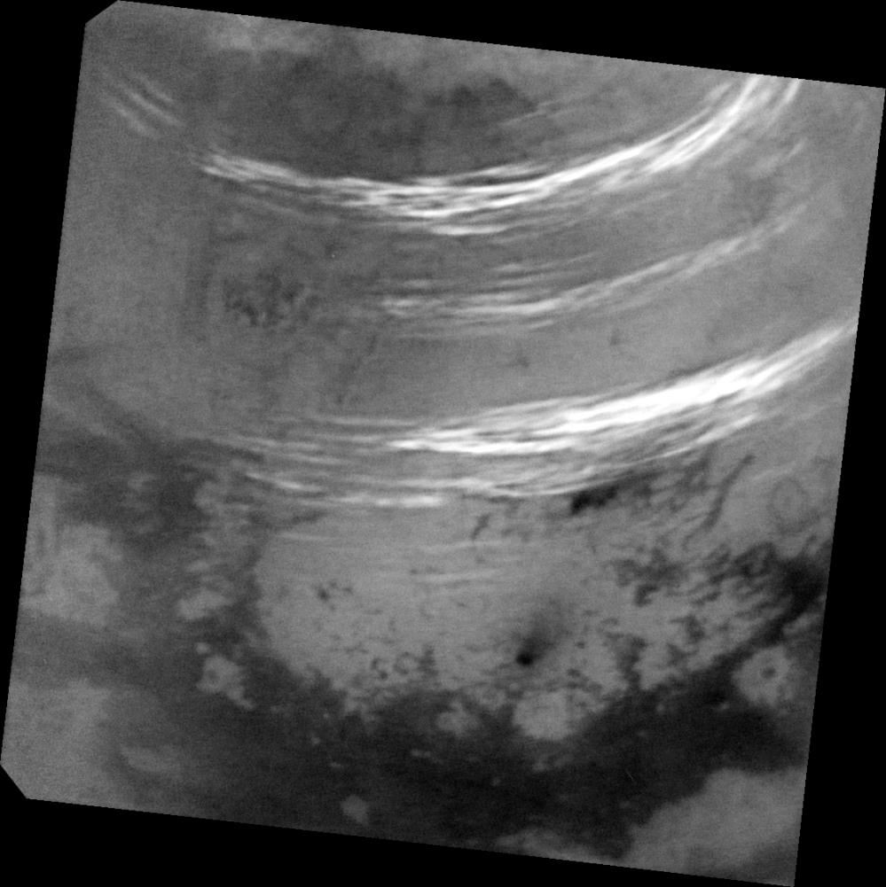
Three methane cloud bands visible in this view: the southern band is located between 30 and 38 degrees north latitude. Scientists have not spotted many clouds in this latitude range prior this observation. A fainter, middle band between 44 and 50 degrees north latitude is in a region where cloud bands have been observed fairly regularly over the past year. A northern band is also seen between 52 and 59 degrees north latitude.
There are a few isolated cloud streaks outside these bands, including some near the southern edge of the north polar terrain near 63 degrees north and another set that goes as far south as 23 degrees north latitude.
Just above the dark, equatorial dunelands at bottom is a dark feature with a streak that points toward the northeast (toward upper right). This feature is named Omacatl Macula, and is likely a region of dark dust that is organized into dunes in some places.
The image was taken on May 7, 2017, at a distance of 311,000 miles (500,000 kilometers). The view is an orthographic projection centered on 37.5 degrees north latitude, 45 degrees west longitude. An orthographic view is most like the view seen by a distant observer. Image scale is about 2 miles (3 kilometers) per pixel.
The Cassini mission is a cooperative project of NASA, ESA (the European Space Agency) and the Italian Space Agency. The Jet Propulsion Laboratory, a division of the California Institute of Technology in Pasadena, manages the mission for NASA's Science Mission Directorate, Washington. The Cassini orbiter and its two onboard cameras were designed, developed and assembled at JPL. The imaging operations center is based at the Space Science Institute in Boulder, Colorado.
For more information about the Cassini-Huygens mission visit https://saturn.jpl.nasa.gov and https://www.nasa.gov/cassini. The Cassini imaging team homepage is at https://ciclops.org.