Annotated Version
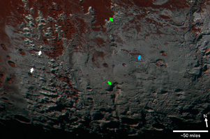
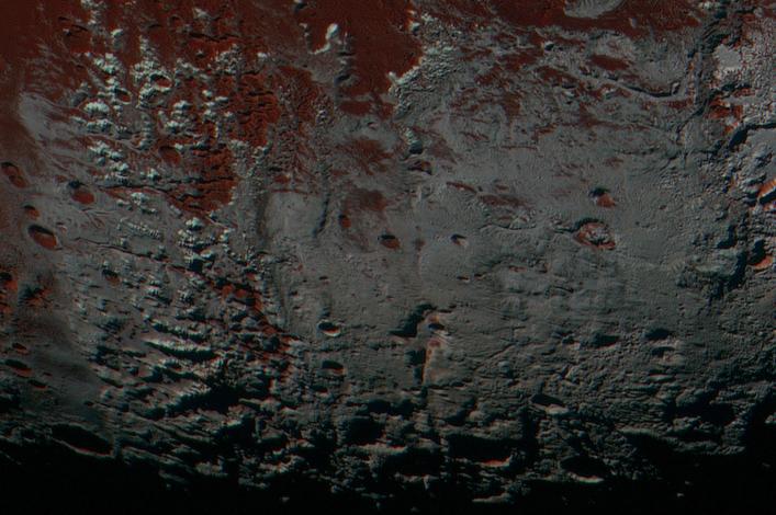
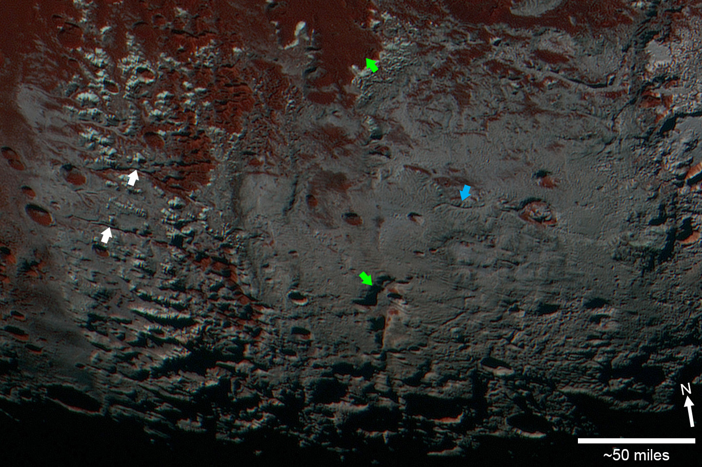
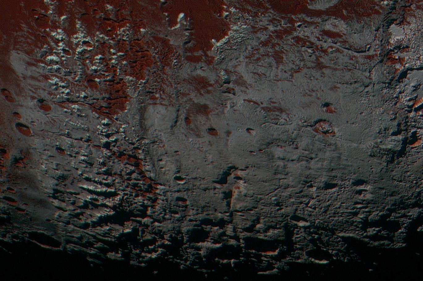
Click on the image for larger versionThis area is south of Pluto's dark equatorial band informally named Cthulhu Regio, and southwest of the vast nitrogen ice plains informally named Sputnik Planitia. North is at the top; in the western portion of the image, a chain of bright mountains extends north into Cthulhu Regio. New Horizons compositional data indicate the bright snowcap material covering these mountains isn't water, but atmospheric methane that has condensed as frost onto these surfaces at high elevation. Between some mountains are sharply cut valleysindicated by the white arrows. These valleys are each a few miles across and tens of miles long.
A similar valley system in the expansive plains to the east (blue arrows) appears to be branched, with smaller valleys leading into it. New Horizons scientists think flowing nitrogen ice that once covered this area -- perhaps when the ice in Sputnik was at a higher elevation -- may have formed these valleys. The area is also marked by irregularly shaped, flat-floored depressions (green arrows) that can reach more than 50 miles (80 kilometers) across and almost 2 miles (3 kilometers) deep. The great widths and depths of these depressions suggest that they may have formed when the surface collapsed, rather than through the sublimation of ice into the atmosphere.
This enhanced color image was obtained by New Horizons' Multispectral Visible Imaging Camera (MVIC). The image resolution is approximately 2,230 feet (680 meters) per pixel. It was obtained at a range of approximately 21,100 miles (33,900 kilometers) from Pluto, about 45 minutes before New Horizons' closest approach to Pluto on July 14, 2015.
The Johns Hopkins University Applied Physics Laboratory in Laurel, Maryland, designed, built, and operates the New Horizons spacecraft, and manages the mission for NASA's Science Mission Directorate. The Southwest Research Institute, based in San Antonio, leads the science team, payload operations and encounter science planning. New Horizons is part of the New Frontiers Program managed by NASA's Marshall Space Flight Center in Huntsville, Alabama.


