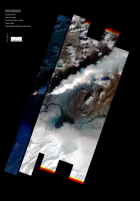
On Sept. 3, 2014, the Hyperion and Advanced Land Imager (ALI) on NASA's Earth Observing 1 (EO-1) spacecraft observed the ongoing eruption at Holuhraun, Iceland, from an altitude of 438 miles (705 kilometers). Data were collected at a resolution of 98 feet (30 meters) per pixel at different visible and infrared wavelengths.
The image on the right shows the combined ALI and Hyperion data (a narrow strip at the western edge of the broad ALI swath). To the south is the edge of Dyngjujökull (an icecap) and to the north is the circular lake at another volcano called Askja. The ongoing eruption is from a fissure over 0.6 miles (1 kilometer) long, feeding lava flows and generating a plume of water vapor and ash.
The image strip to the left is constructed from the Hyperion data at infrared wavelengths, and emphasizes the hottest areas at and adjacent to the vent. The radiant heat is estimated at more than 3,000 Megawatts. The eruption is being closely monitored by scientists at the Icelandic Meteorological Office and the University of Iceland.
The EO-1 spacecraft is managed by NASA's Goddard Space Flight Center, Greenbelt, Maryland. EO-1 is the satellite remote-sensing asset used by the EO-1 Volcano Sensor Web (VSW) developed by NASA's Jet Propulsion Laboratory, Pasadena, California, which is being used to monitor this, and other, volcanic eruptions around the world.