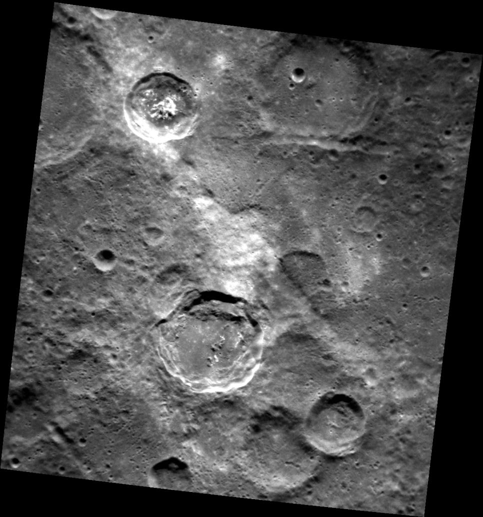
In the center of this image is a high-reflectance area that seems to be confined to a region of lower elevation that is bounded by linear scarp (cliff) segments. Such diffuse bright areas are sometimes related to the deposition of small secondary craters and ray segments by a relatively recent impact crater, but looking at regional images (for example, using QuickMap), there are no rayed craters in the immediate vicinity (though Han Kan might be a candidate). Therefore, a compositional difference may account for the difference in the albedo (brightness) of the material in the low-lying area. Are the scarps tectonic in nature (the result of vertical movement along faults), or were they formed by secondary crater chains? Also of interest in the scene are hollows on the central peak of the crater at the upper left, and the smooth impact melt on the floor of the terrace-walled crater just below center. Scientists will be at work for many years to solve the puzzle of Mercury's complicated geological history!
This image was acquired as part of the NAC ride-along imaging campaign. When data volume is available and MDIS is not acquiring images for its other campaigns, high-resolution NAC images are obtained of the surface. These images are designed not to interfere with other instrument observations but take full advantage of periods during the mission when extra data volume is available.
Date acquired: May 19, 2012
Image Mission Elapsed Time (MET): 245904903
Image ID: 1853014
Instrument: Narrow Angle Camera (NAC) of the Mercury Dual Imaging System (MDIS)
Center Latitude: -47.3°
Center Longitude: 177.3° E
Resolution: 179 meters/pixel
Scale: The scene is about 184 km (114 mi.) across
Incidence Angle: 47.7°
Emission Angle: 24.2°
Phase Angle: 71.9°
The MESSENGER spacecraft is the first ever to orbit the planet Mercury, and the spacecraft's seven scientific instruments and radio science investigation are unraveling the history and evolution of the Solar System's innermost planet. MESSENGER acquired over 150,000 images and extensive other data sets. MESSENGER is capable of continuing orbital operations until early 2015.
For information regarding the use of images, see the MESSENGER image use policy.
 Planetary Data System


