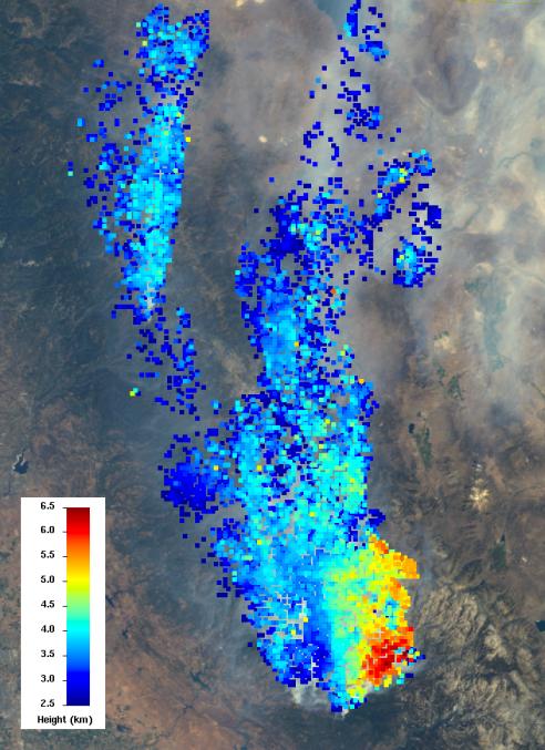
The Multi-angle Imaging SpectroRadiometer (MISR) instrument on NASA's Terra spacecraft views every scene it observes from nine different angles. This unique design allows it to measure the height of smoke plumes using stereoscopic techniques. This MISR image, acquired Aug. 23, 2013, shows a 121-by-165-mile (194-by-266 kilometer) portion of the scene, where the smoke is the thickest. The colors indicate the height of the smoke plume's top above sea level. The data show that the smoke particles have reached altitudes as high as 4 miles (6.5 kilometers). These heights have not been corrected for the effects of wind, but have an uncertainty of less than 0.6 mile (1 kilometer).
MISR was built and is managed by NASA's Jet Propulsion Laboratory, Pasadena, Calif., for NASA's Science Mission Directorate, Washington, D.C. The Terra satellite is managed by NASA's Goddard Space Flight Center, Greenbelt, Md. The MISR data were obtained from the NASA Langley Research Center Atmospheric Science Data Center. JPL is a division of the California Institute of Technology.