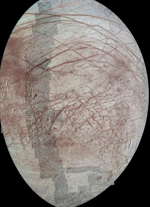
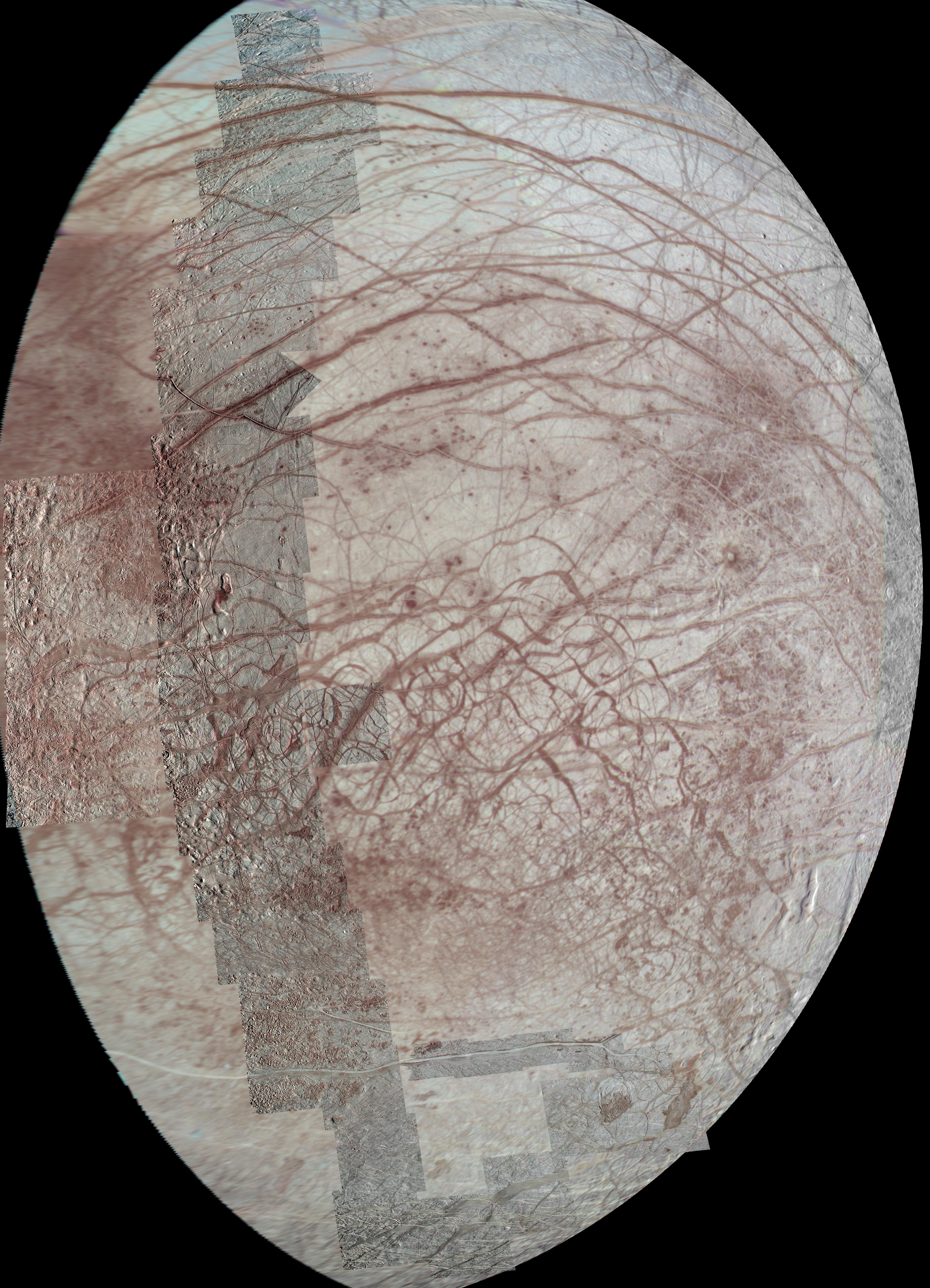
This view of Jupiter's moon Europa features several regional-resolution mosaics overlaid on a lower resolution global view for context. The regional views were obtained during several different flybys of the moon by NASA's Galileo mission, and they stretch from high northern to high southern latitudes. Prominent here are the long, arcuate (or arc-shaped) and linear markings called lineae (Latin for strings or threads), which are a signature feature of Europa's surface. Color saturation has been enhanced to bring out the subtle red coloration present along many of the lineae. The color data extends into the infrared, showing bluish ice (indicating larger ice grains) in the polar regions.
The terrain in this view stretches from the side of Europa that always trails in its orbit at left (west), to the side that faces away from Jupiter at right (east). In addition to the lineae, the regional-scale images contain many interesting features, including lenticulae (small spots), chaos terrain, maculae (large spots), and the unusual bright band known as Agenor Linea in the south.
The regional-resolution mosaics enhance the amount of detail visible in a previously released view of the same region on Europa, [see PIA02590]. While the earlier image uses much of the same low-resolution data, its images are projected from a different angle and are processed with greater color saturation.
This view is an orthographic projection centered on 5.53 degrees south latitude, 214.5 degrees west longitude and has a resolution of 1600 feet (500 meters) per pixel. An orthographic view is like the view seen by a distant observer looking through a telescope.
The mosaic was constructed from individual images obtained by the Solid State Imaging (SSI) system on NASA's Galileo spacecraft during six flybys of Europa between 1996 and 1999 (flybys designated G1, E11, E14, E15, E17, and E19).