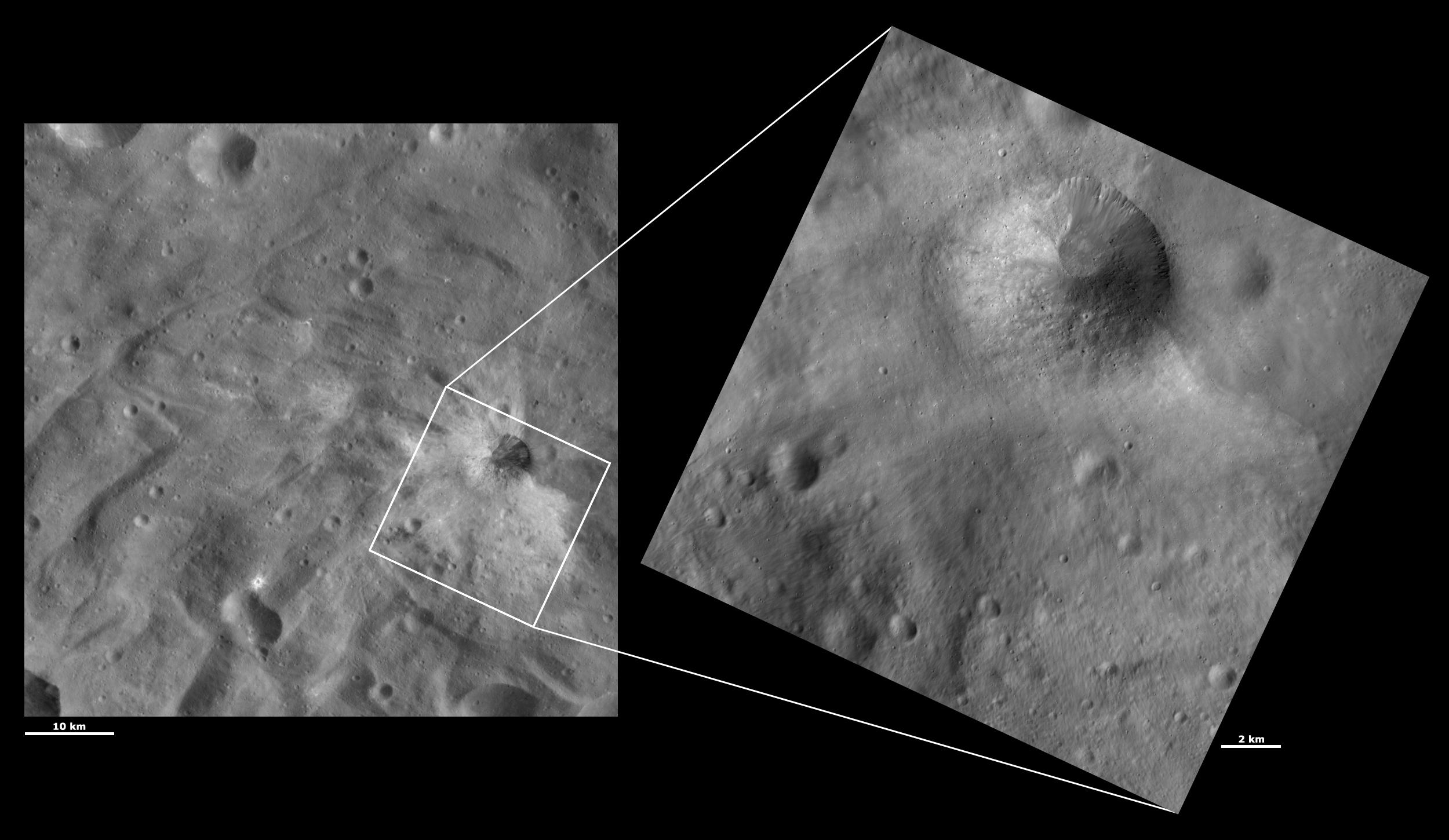
These Dawn framing camera (FC) images of Vesta show Justina crater at both HAMO (high-altitude mapping orbit) and LAMO (low-altitude mapping orbit) resolutions. The left image is the HAMO image and the right image is the LAMO image. Justina crater is the largest crater in the top part of the LAMO image. The LAMO image is approximately 3 times better spatial resolution than the HAMO image. In images with higher spatial resolutions smaller objects can be better distinguished. Over half of Justina crater is buried by material that slumped over it. This slumped material makes most of the rim of Justina look very degraded while only the top right part of the rim is sharp and fresh. Many boulders that can not be seen in the HAMO image can be seen on top of the slump in the LAMO image. Also, the mottled appearance of the slump and small gullies around the fresh rim of the crater become clear in the LAMO image.
These images are located in Vesta's Urbinia quadrangle, in Vesta's southern hemisphere. NASA's Dawn spacecraft obtained the left image with its framing camera on Oct. 22, 2011. This image was taken through the camera's clear filter. The distance to the surface of Vesta is 700 kilometers (435 miles) and the image has a resolution of about 65 meters (213 feet) per pixel. This image was acquired during the HAMO (high-altitude mapping orbit) phase of the mission. NASA's Dawn spacecraft obtained the right image with its framing camera on Dec. 27, 2011. This image was taken through the camera's clear filter. The distance to the surface of Vesta is 272 kilometers (169 miles) and the image has a resolution of about 19 meters (62 feet) per pixel. This image was acquired during the LAMO (low-altitude mapping orbit) phase of the mission.
The Dawn mission to Vesta and Ceres is managed by NASA's Jet Propulsion Laboratory, a division of the California Institute of Technology in Pasadena, for NASA's Science Mission Directorate, Washington D.C. UCLA is responsible for overall Dawn mission science. The Dawn framing cameras have been developed and built under the leadership of the Max Planck Institute for Solar System Research, Katlenburg-Lindau, Germany, with significant contributions by DLR German Aerospace Center, Institute of Planetary Research, Berlin, and in coordination with the Institute of Computer and Communication Network Engineering, Braunschweig. The framing camera project is funded by the Max Planck Society, DLR, and NASA/JPL.
More information about Dawn is online at http://www.nasa.gov/dawn and http://dawn.jpl.nasa.gov.
 Planetary Data System


