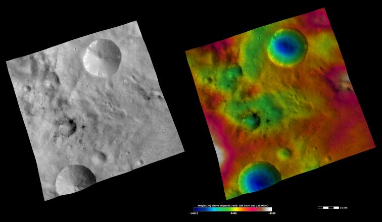
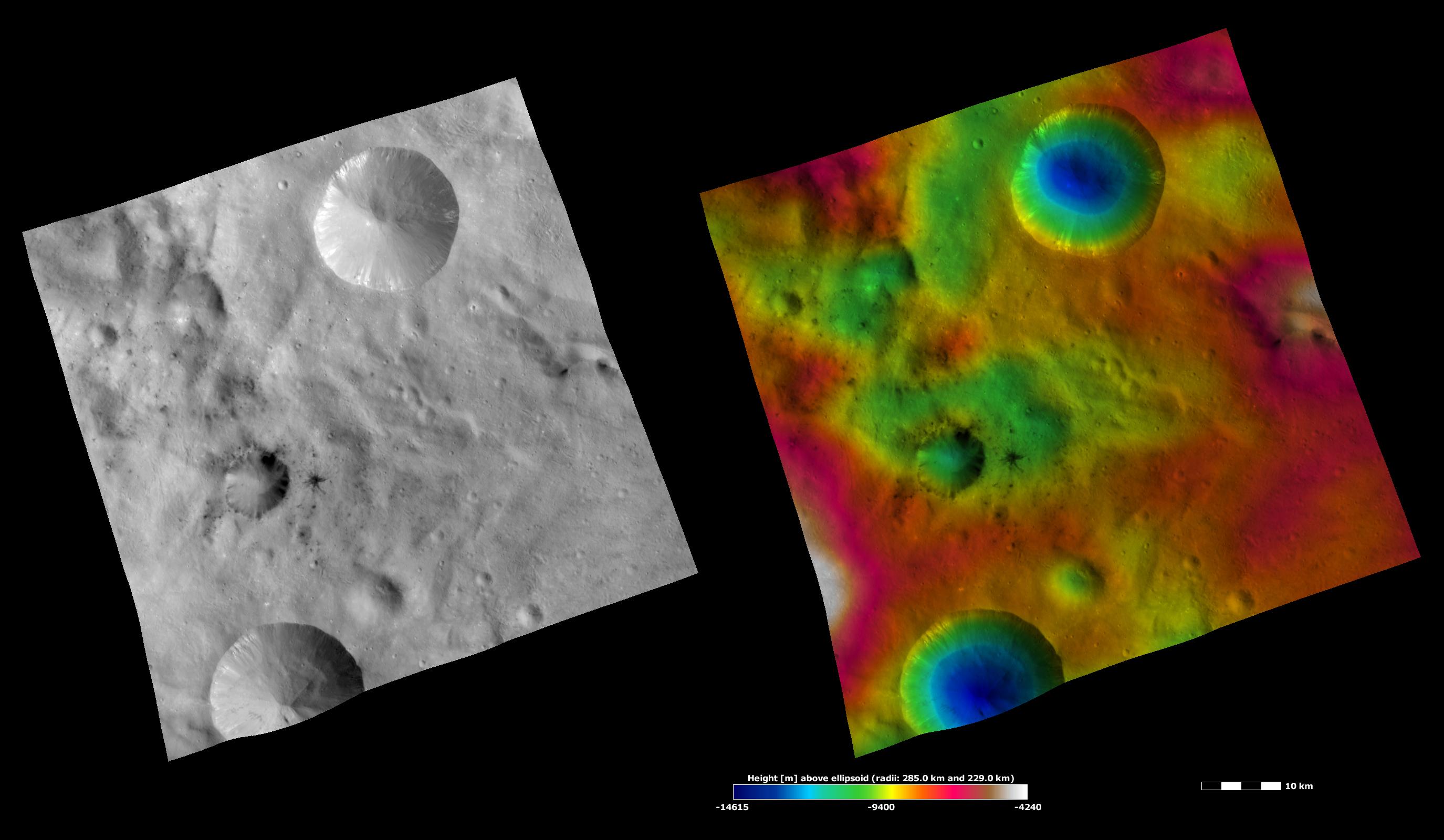
The left-hand image is a Dawn FC (framing camera) image, which shows the apparent brightness of Vesta's surface. The right-hand image is based on this apparent brightness image, which has had a color-coded height representation of the topography overlain onto it. The topography is calculated from a set of images that were observed from different viewing directions, which allows stereo reconstruction. The various colors correspond to the height of the area. The white and red areas in the topography image are the highest areas and the blue areas are the lowest areas. Laelia crater is the crater surrounded by dark material offset to the left of the center of the image. Sextilia crater is the large crater in the top of the images with bright material around its rim. In the apparent brightness image it is clear that some of the dark material associated with Laelia crater crops out from its rim and slumps towards its center and that some has been excavated by smaller craters surrounding Laelia. The bowl shape of Sextilia crater is seen in the topography image.
These images are located in Vesta's Sextilia quadrangle, in Vesta's southern hemisphere. NASA's Dawn spacecraft obtained the apparent brightness image with its framing camera on Oct. 2, 2011. This image was taken through the camera's clear filter. The distance to the surface of Vesta is 700 kilometers (435 miles) and the image has a resolution of about 70 meters per pixel. This image was acquired during the HAMO (high-altitude mapping orbit) phase of the mission. These images are lambert-azimuthal map projected.
The Dawn mission to Vesta and Ceres is managed by NASA's Jet Propulsion Laboratory, a division of the California Institute of Technology in Pasadena, for NASA's Science Mission Directorate, Washington D.C. UCLA is responsible for overall Dawn mission science. The Dawn framing cameras have been developed and built under the leadership of the Max Planck Institute for Solar System Research, Katlenburg-Lindau, Germany, with significant contributions by DLR German Aerospace Center, Institute of Planetary Research, Berlin, and in coordination with the Institute of Computer and Communication Network Engineering, Braunschweig. The framing camera project is funded by the Max Planck Society, DLR, and NASA/JPL.
More information about Dawn is online at http://www.nasa.gov/dawn and http://dawn.jpl.nasa.gov.
 Planetary Data System


