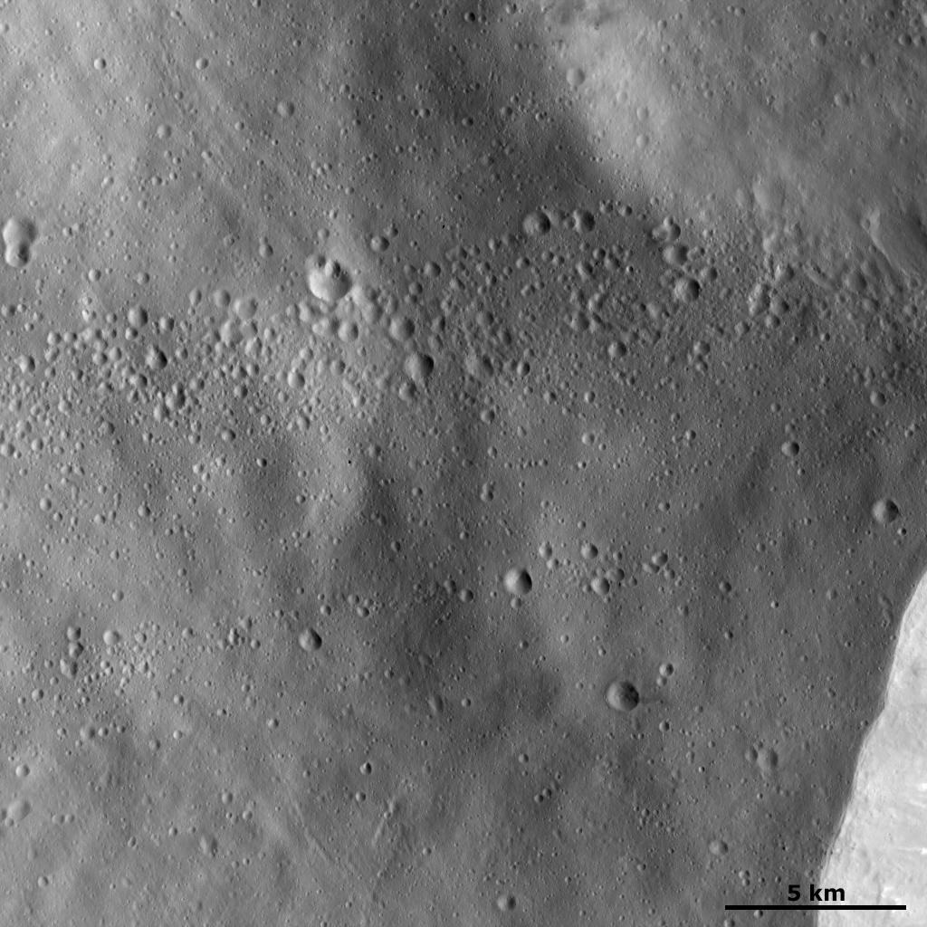
This Dawn framing camera (FC) image of Vesta shows lines of craters less than 1 kilometer (0.6 mile) diameter in size, which lie on top of a relatively smooth surface. This smooth surface is likely formed by fine-grained material that has been ejected from a nearby larger impact crater. Perhaps the source crater of this fine grained ejecta material is the large crater, a part of whose rim can be seen in the bottom right of the image. It is possible that the small craters are arranged into lines because they are secondary craters that were also ejected from the large crater as it formed. It is unlikely that the craters would form in such a pattern if the material that made them had originated from space.
This image is located in Vesta's Pinaria quadrangle, south of Vesta's equator. NASA's Dawn spacecraft obtained this image with its framing camera on Jan. 22, 2012. This image was taken through the camera's clear filter. The distance to the surface of Vesta is 272 kilometers (169 miles) and the image has a resolution of about 25 meters (82 feet) per pixel. This image was acquired during the LAMO (low-altitude mapping orbit) phase of the mission.
The Dawn mission to Vesta and Ceres is managed by NASA's Jet Propulsion Laboratory, a division of the California Institute of Technology in Pasadena, for NASA's Science Mission Directorate, Washington D.C. UCLA is responsible for overall Dawn mission science. The Dawn framing cameras have been developed and built under the leadership of the Max Planck Institute for Solar System Research, Katlenburg-Lindau, Germany, with significant contributions by DLR German Aerospace Center, Institute of Planetary Research, Berlin, and in coordination with the Institute of Computer and Communication Network Engineering, Braunschweig. The Framing Camera project is funded by the Max Planck Society, DLR, and NASA/JPL.
More information about the Dawn mission is online at http://www.nasa.gov/dawn and http://dawn.jpl.nasa.gov.
 Planetary Data System


