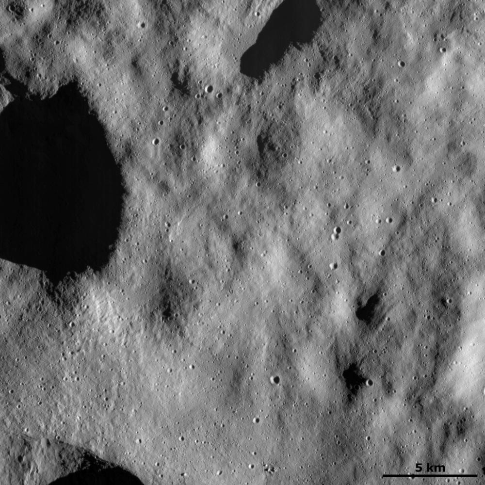
This Dawn FC (framing camera) image shows a relatively smooth part of Vesta's surface. This smooth texture is probably due to the surface being covered in a layer of tiny dust particles. Generally, smaller particles look smoother than larger particles in images such as those taken by Dawn of Vesta. The outlines of some old, degraded craters can be seen below this later of dust. On top of this dust layer are young, small, fresh craters, which must have been formed by objects hitting the surface since the dust layer was laid down. There are also a number of grooves, running diagonally across the image, on top of the dust layer.
This image is located in Vesta's Bellicia quadrangle and the center of the image is 25.7 degrees north latitude, 22.4 degrees east longitude. NASA's Dawn spacecraft obtained this image with its framing camera on Dec. 13, 2011. This image was taken through the camera's clear filter. The distance to the surface of Vesta is 272 kilometers (163 miles) and the image has a resolution of about 25 meters (82 feet) per pixel. This image was acquired during the LAMO (low-altitude mapping orbit) phase of the mission.
The Dawn mission to Vesta and Ceres is managed by NASA's Jet Propulsion Laboratory, a division of the California Institute of Technology in Pasadena, for NASA's Science Mission Directorate, Washington D.C. UCLA is responsible for overall Dawn mission science. The Dawn framing cameras have been developed and built under the leadership of the Max Planck Institute for Solar System Research, Katlenburg-Lindau, Germany, with significant contributions by DLR German Aerospace Center, Institute of Planetary Research, Berlin, and in coordination with the Institute of Computer and Communication Network Engineering, Braunschweig. The Framing Camera project is funded by the Max Planck Society, DLR, and NASA/JPL.
More information about the Dawn mission is online at http://www.nasa.gov/dawn and http://dawn.jpl.nasa.gov.
 Planetary Data System


