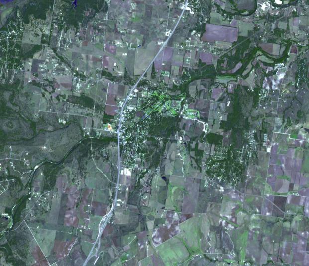
The Debra L. Friedkin archaeological site near Salado, Texas is a multicomponent site, with Clovis remains overlying pre-Clovis stone tools. The discoverers of the pre-Clovis site claim that this was an occupation site, and their dates of 15,500 years before present pre-date Clovis dates by several thousand years (Michael Waters and associates in March 25, 2011 Science magazine article). The site is located within the floodplain of Buttermilk Creek; it is also about 250m from the Gault Clovis site, the largest Clovis site in North America. Many sites older than Clovis sites have been found in recent decades, destroying the Clovis-first paradigm, and convincingly proving that the Americas were settled much earlier than originally thought. The image was acquired October 20, 2005, covers an area of 13.6 x 12 km, and is located near 30.9 degrees north latitude, 97.5 degrees west longitude.
With its 14 spectral bands from the visible to the thermal infrared wavelength region and its high spatial resolution of 15 to 90 meters (about 50 to 300 feet), ASTER images Earth to map and monitor the changing surface of our planet. ASTER is one of five Earth-observing instruments launched Dec. 18, 1999, on Terra. The instrument was built by Japan's Ministry of Economy, Trade and Industry. A joint U.S./Japan science team is responsible for validation and calibration of the instrument and data products.
The broad spectral coverage and high spectral resolution of ASTER provides scientists in numerous disciplines with critical information for surface mapping and monitoring of dynamic conditions and temporal change. Example applications are: monitoring glacial advances and retreats; monitoring potentially active volcanoes; identifying crop stress; determining cloud morphology and physical properties; wetlands evaluation; thermal pollution monitoring; coral reef degradation; surface temperature mapping of soils and geology; and measuring surface heat balance.
The U.S. science team is located at NASA's Jet Propulsion Laboratory, Pasadena, Calif. The Terra mission is part of NASA's Science Mission Directorate, Washington, D.C.
More information about ASTER is available at http://asterweb.jpl.nasa.gov/.