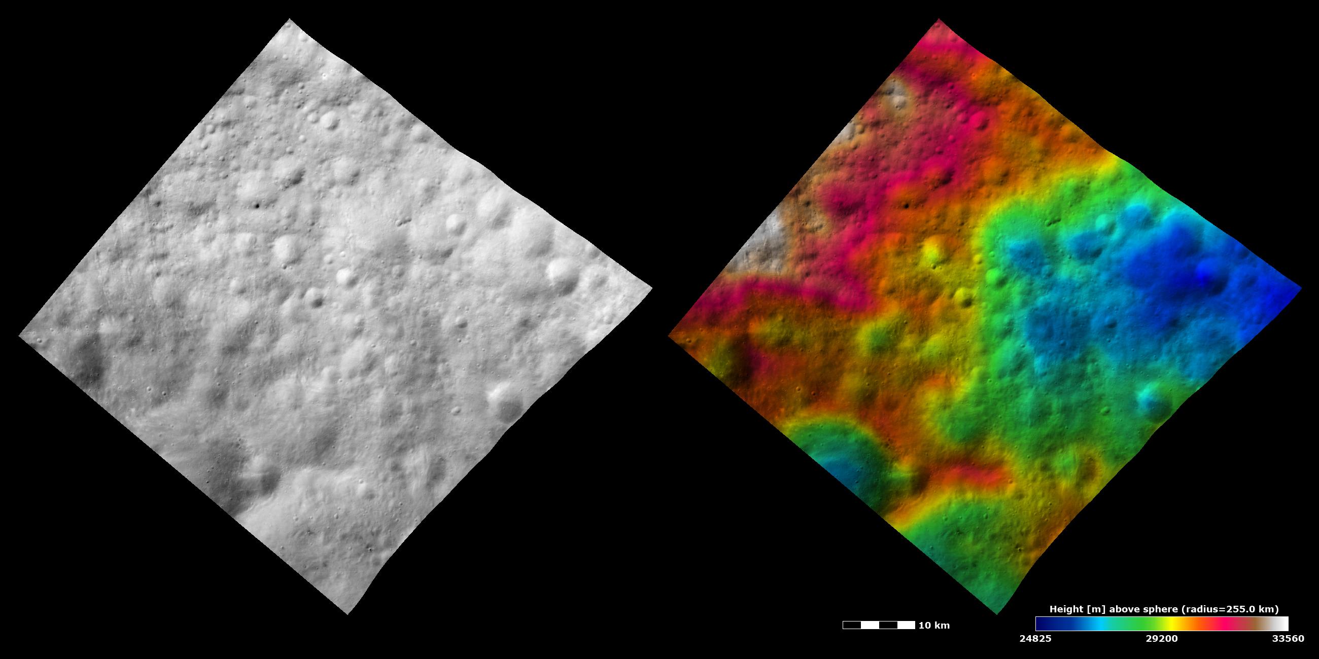
These Dawn FC (framing camera) images show an old, heavily cratered terrain around Vesta's equator. The left image is an albedo image, which is taken directly through the clear filter of the FC. Such an image shows the albedo (e.g. brightness/darkness) of the surface. The right image uses the same albedo image as its base but then a color-coded height representation of the topography is overlain onto it. The topography is calculated from a set of images that were observed from different viewing directions, allowing stereo reconstruction. The various colors correspond to the height of the area. The red areas in the left of the image are the highest areas and the blue areas in the right of the image are the lowest areas. The heavily cratered nature of this terrain is clear in the albedo image. However, there is a roughly elliptical depression visible in the right of the topography image (colored blue) that is not as clear in the albedo image. This depression is probably a very old, ruined crater. It does not show up as well in the albedo image because it has been covered by later impact craters and has had its rim eroded. Another smaller, younger crater is visible as a blue depression in the lower left of the topography image. It is not as old or degraded/ eroded as the ruined crater so shows up better in the albedo image.
These images are centered in Vesta's Numisia quadrangle and the center latitude and longitude of the image is 1.3°N, 243.6°E. NASA's Dawn spacecraft obtained this image with its framing camera on October 26th 2011. This image was taken through the camera's clear filter. The distance to the surface of Vesta is 700 km and the image has a resolution of about 60 meters per pixel. This image was acquired during the HAMO (High Altitude Mapping Orbit) phase of the mission. The images are lambert-azimuthal map projected.
The Dawn mission to Vesta and Ceres is managed by NASA's Jet Propulsion Laboratory, a division of the California Institute of Technology in Pasadena, for NASA's Science Mission Directorate, Washington D.C. UCLA is responsible for overall Dawn mission science. Dawn's VIR was provided by ASI, the Italian Space Agency and is managed by INAF, Italy's National Institute for Astrophysics, in collaboration with Selex Galileo, where it was built.
More information about Dawn is online at http://www.nasa.gov/dawn and http://dawn.jpl.nasa.gov.
 Planetary Data System


