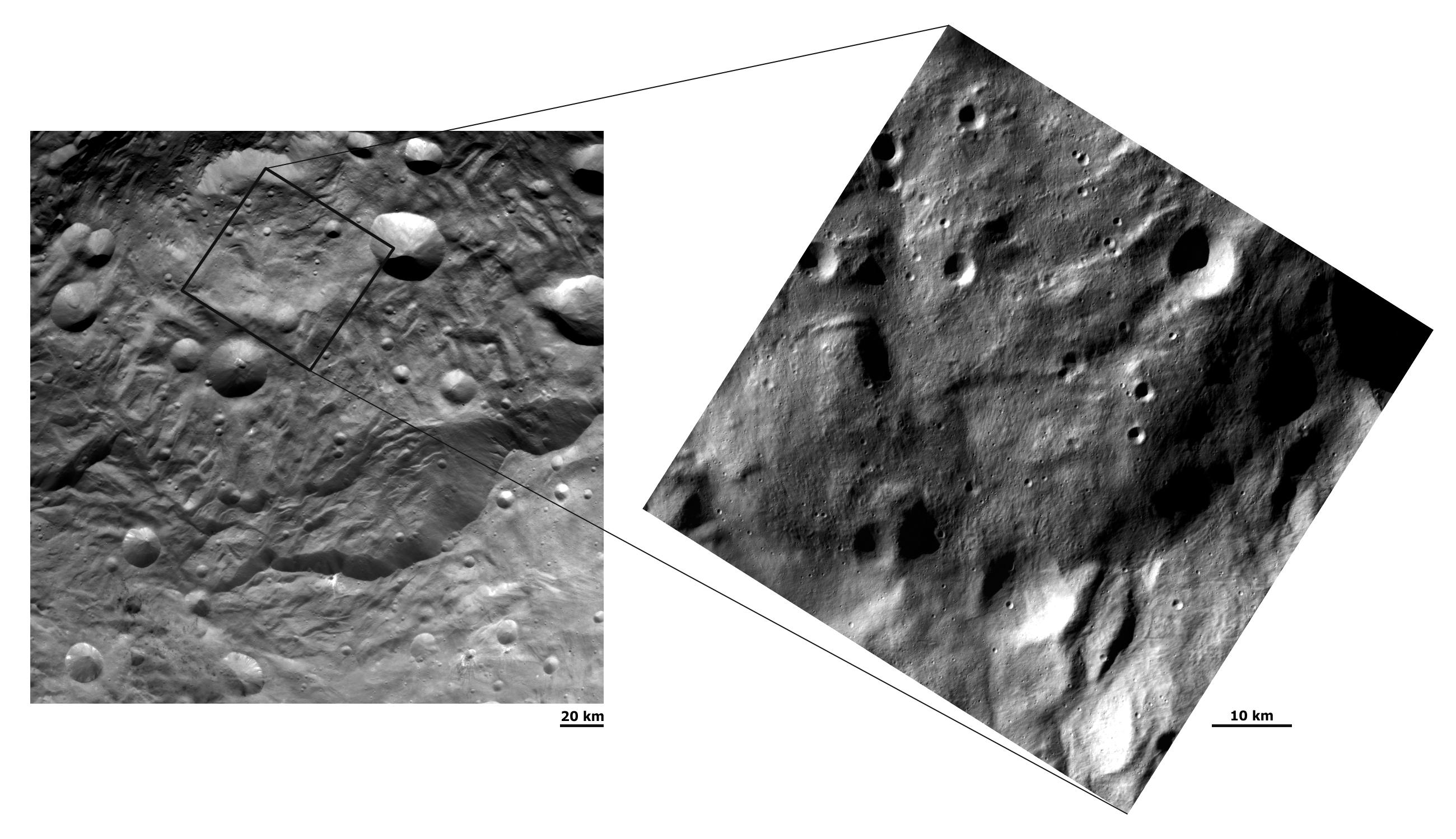
These details of Dawn FC (framing camera) images have different resolutions and show hummocky (e.g. wavy/undulating) terrain, grooves and small impacts in Vesta's south polar region. The image on the left has a resolution of about 260 meters per pixel and the image on the right has a resolution of about 70 meters per pixel. The left hand image shows scarps (mostly near the bottom of the image) surrounding the depression and raised mound in the south polar region. The right hand image is a close up, higher resolution view of a large part of the raised mound. This mound appears to be made of slightly darker material, which seems to overlie the slightly brighter material of the depression surrounding it. The higher resolution image (70 meters per pixel) shows clear linear structures and grooves on this mound, which run approximately vertically across the image. Many more small craters are also clear in the 70 meters per pixel image than in the 260 meters per pixel image. The increased detail visible in the 70 meters per pixel image highlights the importance of high resolution images in planetary exploration.
NASA's Dawn spacecraft obtained these images with its framing camera on August 17, and September 17, 2011. These images were taken through the camera's clear filter from a distance to the surface of 2740km and 750km respectively. These images have a resolution of about 260 meters per pixel and about 70 meters per pixel.
The Dawn mission to Vesta and Ceres is managed by NASA's Jet Propulsion Laboratory, a division of the California Institute of Technology, Pasadena, Calif., for NASA's Science Mission Directorate, Washington. UCLA is responsible for overall Dawn mission science. The Dawn framing cameras were developed and built under the leadership of the Max Planck Institute for Solar System Research, Katlenburg-Lindau, Germany, with significant contributions by DLR German Aerospace Center, Institute of Planetary Research, Berlin, and in coordination with the Institute of Computer and Communication Network Engineering, Braunschweig. The Framing Camera project is funded by the Max Planck Society, DLR, and NASA/JPL.
More information about Dawn is online at http://www.nasa.gov/dawn and http://dawn.jpl.nasa.gov.
 Planetary Data System


