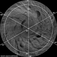
Gridded Version
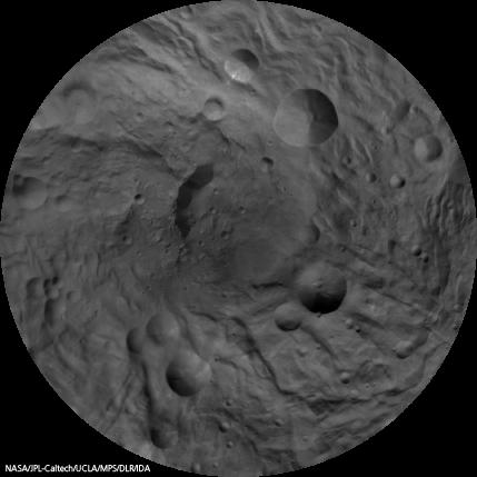
Click on the image for larger viewThis image mosaic of Vesta's south pole is generated from dozens of individual images obtained by the framing camera aboard NASA's Dawn spacecraft. The images have been recorded from an altitude of about 1,700 miles (2,700 kilometers).
The image map is centered on the asteroid's south pole, which is surrounded by several large impact craters with diameters of about 10 to 30 miles (20 to 50 kilometers). The mosaic is displayed in what cartographers call a stereographic projection. Image resolution is 750 meters per pixel.
The Dawn mission to Vesta and Ceres is managed by NASA's Jet Propulsion Laboratory, a division of the California Institute of Technology in Pasadena, for NASA's Science Mission Directorate, Washington. UCLA is responsible for overall Dawn mission science. The Dawn framing cameras were developed and built under the leadership of the Max Planck Institute for Solar System Research, Katlenburg-Lindau, Germany, with significant contributions by DLR German Aerospace Center, Institute of Planetary Research, Berlin, and in coordination with the Institute of Computer and Communication Network Engineering, Braunschweig. The Framing Camera project is funded by the Max Planck Society, DLR, and NASA/JPL.
More information about Dawn is online at http://www.nasa.gov/dawn and http://dawn.jpl.nasa.gov.