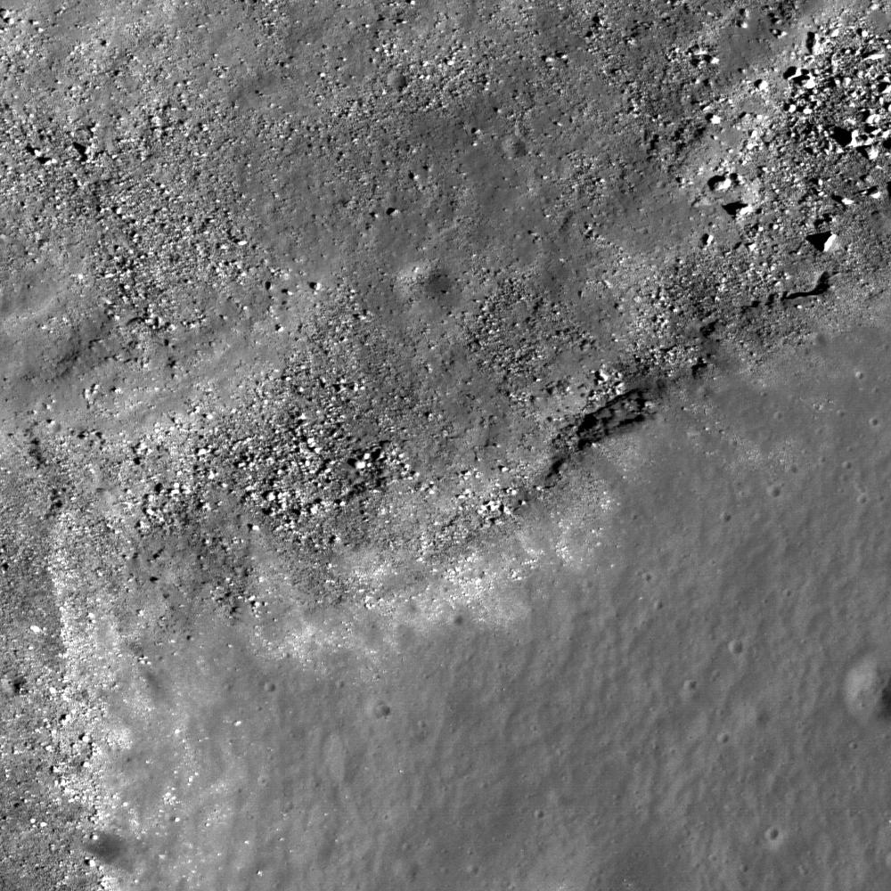
This image from LROC's NAC shows the rim of a large sinuous rille on the western edge of the Marius Hills Constellation region of interest, showing materials that have slumped into the bottom of the sinuous rille towards the northwest as well as (possibly) outcrop, a prime location for fieldwork and sample collection. One of the several hundred volcanic features located in the Marius region. Exploration of this site will yield important insights into planetary volcanism. Image width is 550 meters or 601 yards.
NASA's Goddard Space Flight Center built and manages the mission for the Exploration Systems Mission Directorate at NASA Headquarters in Washington. The Lunar Reconnaissance Orbiter Camera was designed to acquire data for landing site certification and to conduct polar illumination studies and global mapping. Operated by Arizona State University, LROC consists of a pair of narrow-angle cameras (NAC) and a single wide-angle camera (WAC). The mission is expected to return over 70 terabytes of image data.