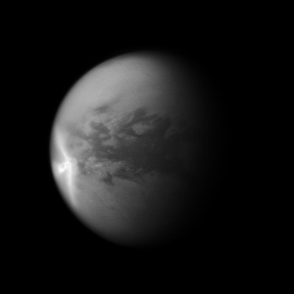
A huge arrow-shaped storm blows across the equatorial region of Titan in this image from NASA's Cassini spacecraft, chronicling the seasonal weather changes on Saturn's largest moon.
This storm created large effects in the form of dark -- likely wet -- areas on the surface of the moon, visible in later images. After this storm dissipated, Cassini observed significant changes on Titan's surface at the southern boundary of the dune field named Belet. Those changes covered an area of 500,000 square kilometers (193,000 square miles), or roughly the combined area of Arizona and Utah in the United States. See PIA12818 to learn more.
The part of the storm that is visible here measures 1,200 kilometers (750 miles) in length east-to-west. The wings of the storm that trail off to the northwest and southwest from the easternmost point of the storm are each 1,500 kilometers (930 miles) long.
Titan's weather has been changing since the August 2009 equinox, when the sun lay directly over the equators of Saturn and its moons, and storms at low latitudes are now more common. See PIA11667 to learn how the sun's illumination of the Saturnian system changed during the equinox transition to spring in the northern hemispheres and to fall in the southern hemispheres of the planet and its moons. See PIA12813 to learn more about Titan's changing weather.
This image is a mosaic of two Cassini images. Most of this view is from an image of the storm captured on Sept. 27, 2010. However, because that image's framing cut off the south polar region of the moon, a second image taken on July 9, 2010, was used to fill in that portion of the moon. This second image was re-projected to the same viewing geometry as the first.
Lit terrain seen here is in the area between the trailing hemisphere, which is the side of Titan that faces backward in its orbit around Saturn, and the side of Titan that always faces away from Saturn. North on Titan (5,150 kilometers or 3,200 miles across) is up. The images were taken with the Cassini spacecraft narrow-angle camera using a spectral filter of near-infrared light centered at 938 nanometers. The view was acquired at a distance of approximately 1.3 million kilometers (808,000 miles) from Titan and at a sun-Titan-spacecraft, or phase, angle of 44 degrees. Image scale is 8 kilometers (5 miles) per pixel.
The Cassini-Huygens mission is a cooperative project of NASA, the European Space Agency and the Italian Space Agency. The Jet Propulsion Laboratory, a division of the California Institute of Technology in Pasadena, manages the mission for NASA's Science Mission Directorate in Washington. The Cassini orbiter and its two onboard cameras were designed, developed and assembled at JPL. The imaging team is based at the Space Science Institute, Boulder, Colo.
For more information about the Cassini-Huygens mission visit http://saturn.jpl.nasa.gov. The Cassini imaging team homepage is at http://ciclops.org.