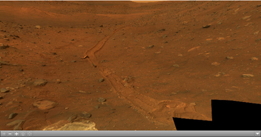
Click on the image to view the QTVR
This full-circle view from the panoramic camera (Pancam) on NASA's Mars Exploration Rover Spirit shows the terrain surrounding the location called "Troy," where Spirit became embedded in soft soil during the spring of 2009. The hundreds of images combined into this view were taken beginning on the 1,906th Martian day (or sol) of Spirit's mission on Mars (May 14, 2009) and ending on Sol 1943 (June 20, 2009).
North is at the center; south at both ends. The western edge of the low plateau called Home Plate dominates the right half of the panorama. At the far right is a bright-topped mound called "Von Braun," a possible future destination for Spirit's exploration. Near the center of the panorama, in the distance, lies Husband Hill, where Spirit recorded views from the summit in 2005. The ridge on the left, near the rover tracks leading to Troy from the north, is called "Tsiolkovsky." For scale, the parallel tracks are about 1 meter (39 inches) apart. The track on the right is more evident because Spirit was driving backwards, dragging its right-front wheel, which no longer rotates.
The bright soil in the center foreground is soft material in which Spirit became embedded after the wheels on that side cut through a darker top layer. The composition of different layers in the soil at the site became the subject of intense investigation by tools on Spirit's robotic arm.
The Pancam team named this scene the camera's Calypso Panorama. This version is an approximate true-color, red-green-blue composite panorama generated from images taken through the Pancam's 750-nanometer, 530-nanometer and 480-nanometer filters. This "natural color" view is the rover team's best estimate of what the scene would look like if we were there and able to see it with our own eyes.
Spirit has been investigating a region within Mars' Gusev Crater for more than 67 months in what was originally planned as a three-month mission.

