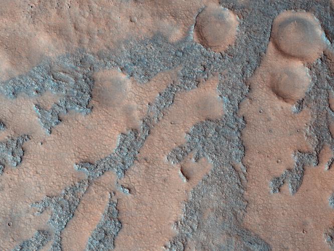
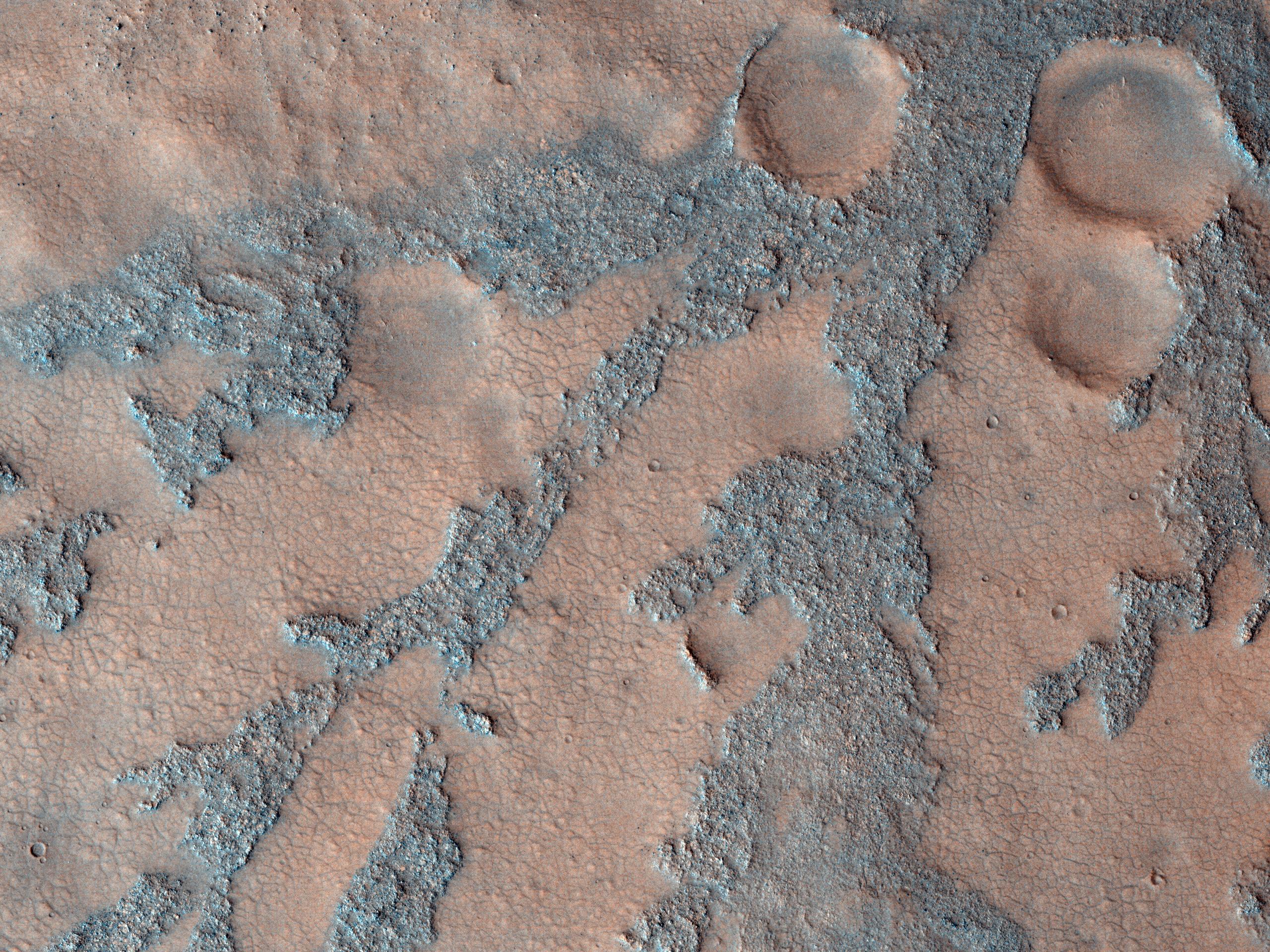
In this image from the High Resolution Imaging Science Experiment (HiRISE) camera on NASA's Mars Reconnaissance Orbiter, the dark branched features in the floor of Antoniadi Crater look like giant ferns, or fern casts. However, these ferns would be several miles in size and are composed of rough rocky materials.
A more likely hypothesis is that this represents a channel network that now stands in inverted relief. The channels may have been lined or filled by indurated materials, making the channel fill more resistant to erosion by the wind than surrounding materials. After probably billions of years of wind erosion the resistant channels are now relatively high-standing. The material between the branched ridges has a fracture pattern and color similar to deposits elsewhere on Mars that are known to be rich in hydrated minerals such as clays.
The inverted channels have short, stubby branches characteristic of formation by groundwater sapping. Spring water seeps into the channels and undercuts overlying layers, which collapse, so the channels grow headward. These images tell the story of an ancient wet environment on Mars, where life could have been possible. Ancient Martian life, if it existed, would most likely consist of microorganisms rather than giant tree ferns.
This image, covering an area about 1 kilometer (0.6 mile) across, is a portion of the HiRISE observation catalogued as ESP_012435_2015, taken on March 22, 2009. The observation is centered at 21.4 degrees north latitude, 61.3 degrees east longitude. The image was taken at a local Mars time of 3:31 p.m. and the scene is illuminated from the west with a solar incidence angle of 66 degrees, thus the sun was about 24 degrees above the horizon. At a solar longitude of 232.1 degrees, the season on Mars is northern autumn.
NASA's Jet Propulsion Laboratory, a division of the California Institute of Technology in Pasadena, manages the Mars Reconnaissance Orbiter for NASA's Science Mission Directorate, Washington. Lockheed Martin Space Systems, Denver, is the prime contractor for the project and built the spacecraft. The High Resolution Imaging Science Experiment is operated by the University of Arizona, Tucson, and the instrument was built by Ball Aerospace & Technologies Corp., Boulder, Colo