 |  |
| Color Movie | Black & White Movie |
Cassini's radar mapper has obtained stereo views of close to 2 percent of Titan's surface during 19 flybys over the last five years. The process of making topographic maps from images is just getting started, but the results already reveal some of the diversity of Titan's geologic features.
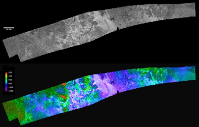
The prominent, roughly circular feature in the western part of this image is an area known as Ganesa Macula. This 180-kilometer-(110-mile)-wide feature crudely resembles steep-sided volcanic domes on Venus that were imaged with the NASA Magellan spacecraft in the 1990s. It was therefore hypothesized initially to be a cryovolcanic feature. The topographic map derived from radar stereo shows that Ganesa as a whole is not elevated, as would be expected for a volcano. Instead, it is tilted (low in the west, high along the eastern margin). Other high and low areas with north-south trending margins alternate to the east of Ganesa. Low areas are consistently filled by radar-bright (rough) channels and flow deposits. The largest of these, in the center of the map with two bright channels leading to triangular fan structures on its western margin, is known as Leliah Fluctus. Although Ganesa Macula could have originated as a cryovolcanic feature (or perhaps as an impact crater, either of which would account for its distinct circular outline), it appears to have been extensively modified by both tectonic (faulting) and fluvial (erosion by fluids derived from rainfall) processes.
The region shown here is centered near 50 degrees north latitude, 80 degrees west longitude, and is about 1,480 kilometers (920 miles) across. The maps are in equirectangular projection with north at the top. The images used for mapping were acquired during flybys on Oct. 26, 2004, and Jan. 13, 2007 (known as Ta and T23). The Ta image is shown in black and white at the top. It has a pixel spacing of 351 meters (about 1,200 feet). Below, the same image is shown with color coding to indicate elevations, as shown by the color bar at left. The total range of relief from purple (low) to red (high) is 1,000 meters (about 3,300 feet).
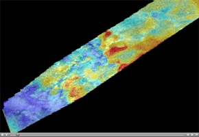
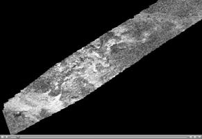
Video clips showing a "flyover" of these regions are shown in Figure 1 (in color) and Figure 2 (in black and white). These movies are vertically exaggerated by 15 times. Elevation is shown in color, from purple (low) to red (high).
The flight path starts by looking down at the area from the north, then flies down to the northeast end of the map and looks more horizontally across to the west. This gives an especially good view of the major flow deposit Leilah Fluctus, the big bright area with two prominent bright triangular extensions on its far (west) side. The flight path then rotates down around the southern side of the area. Note the channels carved into the mountains by the flows that created Leilah Fluctus. The high-standing areas are generally more radar-dark and the low areas are filled with very radar-bright material. This pattern of flow materials being extremely bright is seen in many places on Titan and may have to do with the cobbles (roughly fist-sized rocks) deposited by the flows. Such rocks would reflect the radar signal much more strongly than smooth terrain does. Finally, the flight path continues around the southern edge of Ganesa Macula and then up across the map to look eastward across it. The circular outline of Ganesa shows only in the black and white image and is a little hard to see from this horizontal view.
The color movie (Figure 1) makes it clear that Ganesa is generally high on the eastern side, with a few isolated very high peaks, seen in red, and low on the western side. Other high and low areas with north-south trending margins alternate to the east of Ganesa. Once again, low areas are consistently filled by radar-bright (rocky) channels and flow deposits. Thus, though Ganesa Macula may have originated as a cryovolcanic feature (or an impact crater, either of which would account for its distinct circular outline), it appears to have been extensively modified by both tectonic and fluvial processes.
The Cassini-Huygens mission is a cooperative project of NASA, the European Space Agency and the Italian Space Agency. NASA's Jet Propulsion Laboratory, a division of the California Institute of Technology in Pasadena, manages the mission for NASA's Science Mission Directorate, Washington, D.C. The Cassini orbiter was designed, developed and assembled at JPL. The radar instrument was built by JPL and the Italian Space Agency, working with team members from the United States and several European countries.
For more information about the Cassini-Huygens mission, visit http://saturn.jpl.nasa.gov/index.cfm.

 Planetary Data System


