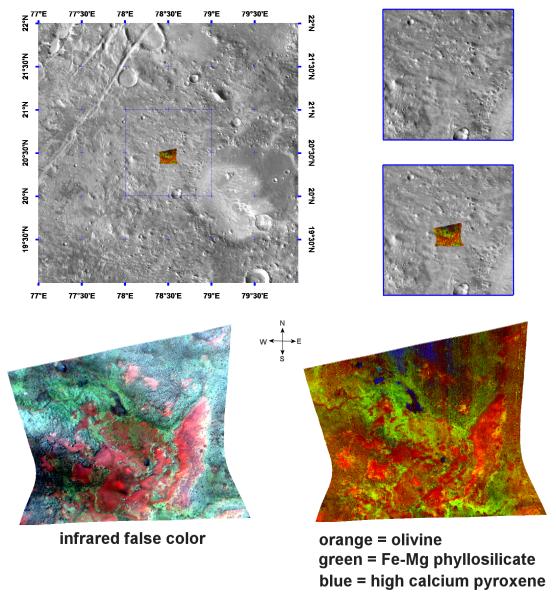
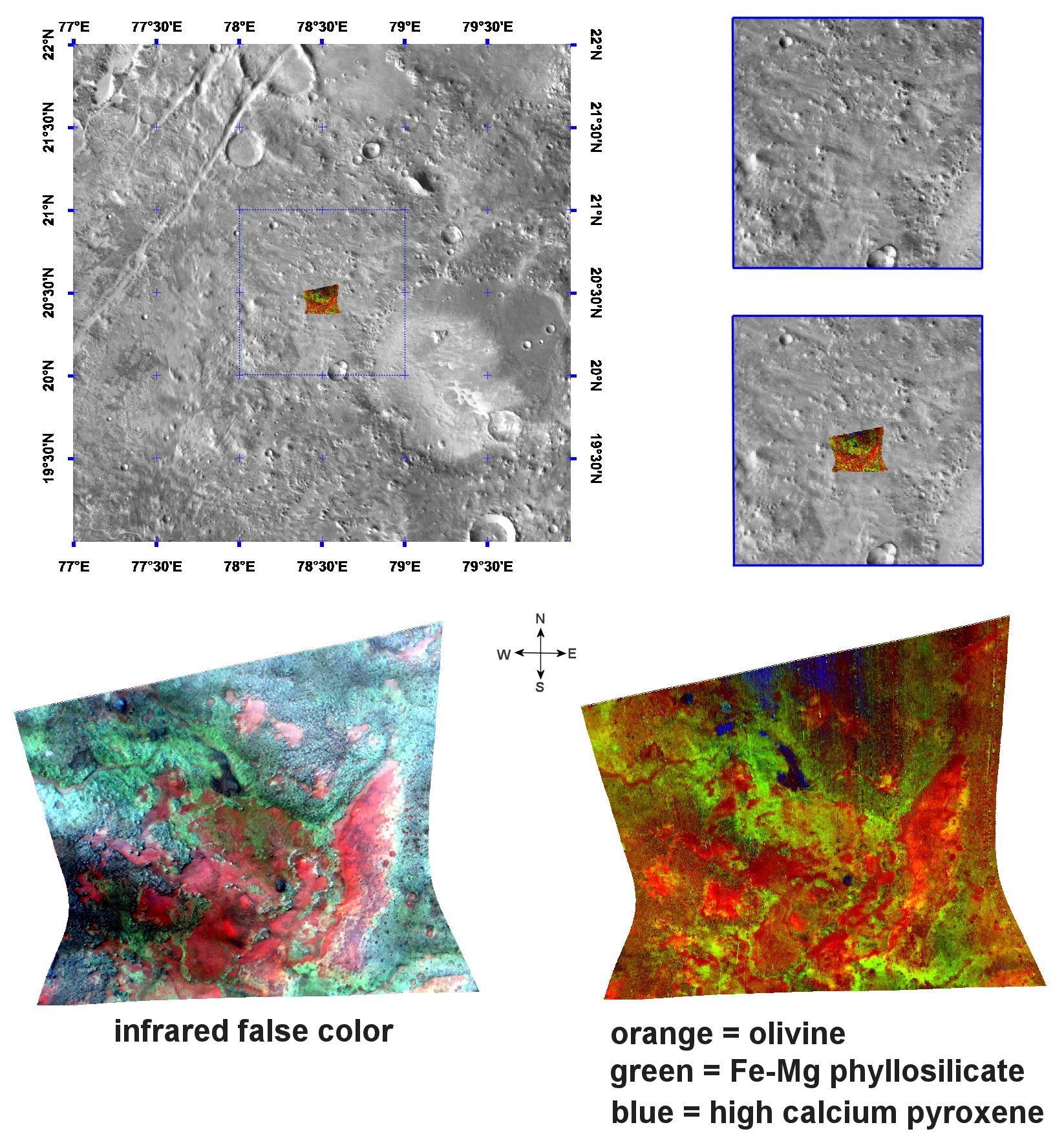
This image of phyllosilicates and olivine in the Nili Fossae region of Mars was taken by the Compact Reconnaissance Imaging Spectrometer for Mars (CRISM) at 0731UTC (3:31 a.m. EDT) on October 4, 2006 near 20.5 degrees north latitude, 78.5 degrees east longitude. The image was taken in 544 colors covering 0.36-3.92 micrometers, and shows features as small as 18 meters (60 feet) across. The image is about 11 kilometers (7 miles) wide at its narrowest point.
Nili Fossae is a long, narrow depression comprised of a series of grabens or down-dropped blocks of crust surrounded by faults. It lies to the northeast of Syrtis Major (a low and broad shield volcano) and to the northwest of an impact basin, Isidis Planitia. Nili Fossae stretches some 667 kilometers (415 miles) toward Utopia Planitia, and has been partially filled by sediments and volcanic lavas.
The top panel in the montage above shows the location of the CRISM image on a mosaic taken by the Mars Odyssey spacecraft's Thermal Emission Imaging System (THEMIS). The CRISM data covers relatively flat terrain with slightly elevated mesas. The lower left image, an infrared false color image, shows the mineralogical complexity of the region. The High-Resolution Imaging Science Experiment (HiRISE), which is also onboard the Mars Reconnaissance Orbiter, has imaged sand dunes in Nili Fossae. When combined with CRISM data, the HiRISE image revealed olivine-rich sand dunes atop clay deposits (see PIA09093).
The lower right image offers further evidence for the region's complex mineralogy. CRISM data reveal olivine (an iron-magnesium containing igneous mineral) in orange, on top of ferromagnesian phyllosilicates (lime green). The phyllosilicates, a category of mineral that includes clays, were exposed during the erosion of overlying rock. The blue areas are remnants of the overlying cap rock containing the igneous mineral pyroxene.
CRISM is one of six science instruments on NASA's Mars Reconnaissance Orbiter. Led by The Johns Hopkins University Applied Physics Laboratory, Laurel, Md., the CRISM team includes expertise from universities, government agencies and small businesses in the United States and abroad. NASA's Jet Propulsion Laboratory, a division of the California Institute of Technology in Pasadena, manages the Mars Reconnaissance Orbiter and the Mars Science Laboratory for NASA's Science Mission Directorate, Washington. Lockheed Martin Space Systems, Denver, built the orbiter.