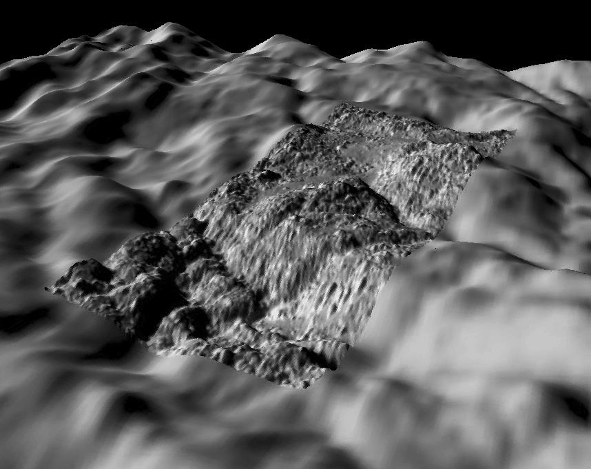
During its July 2005 flyby of Enceladus, Cassini acquired one very high-resolution image of the geologically young and active south polar region. This view was acquired at a resolution of approximately 5 meters and is our highest resolution view of Enceladus. Using a shape-from-shading technique developed at the Lunar and Planetary Institute in Houston TX, Dr. Paul Schenk (http://www.lpi.usra.edu/lpi/schenk/) has produced the first topographic map of this region. This view shows the original high-resolution image together with a simultaneously acquired lower-resolution wide-angle camera context image as background. The image mosaic has been rendered as a perspective view using the topographic map to show the relief as if we are hovering a few kilometers above the rugged terrain, preparing for a landing. Vertical relief has been exaggerated by a factor of 10 to aid interpretation.
The south polar region is extremely young, perhaps less than a few million years old, and has been highly deformed by tectonic faulting, crumpling, and surface disruption. Some smooth material can be seen in a few of the valleys between the rounded hills. This view was obtained near one of the source vents for Enceladus' active plumes. The total relief across the scene is approximately 250 meters. The width of the high-resolution image is approximately 1.75 kilometers (~1 mile), but the small knobs scattered across the surface are only 10 to 50 meters across and 2 to 10 meters high in size on average.
The raw data from which this product was developed were retrieved from the Planetary Data System's Cassini archives. The Cassini-Huygens mission is a cooperative project of NASA, the European Space Agency and the Italian Space Agency. The Jet Propulsion Laboratory, a division of the California Institute of Technology in Pasadena, manages the mission for NASA's Science Mission Directorate, Washington, D.C. The Cassini orbiter and its two onboard cameras were designed, developed and assembled at JPL. The imaging operations center is based at the Space Science Institute in Boulder, Colo. (http://ciclops.org)
 Planetary Data System


