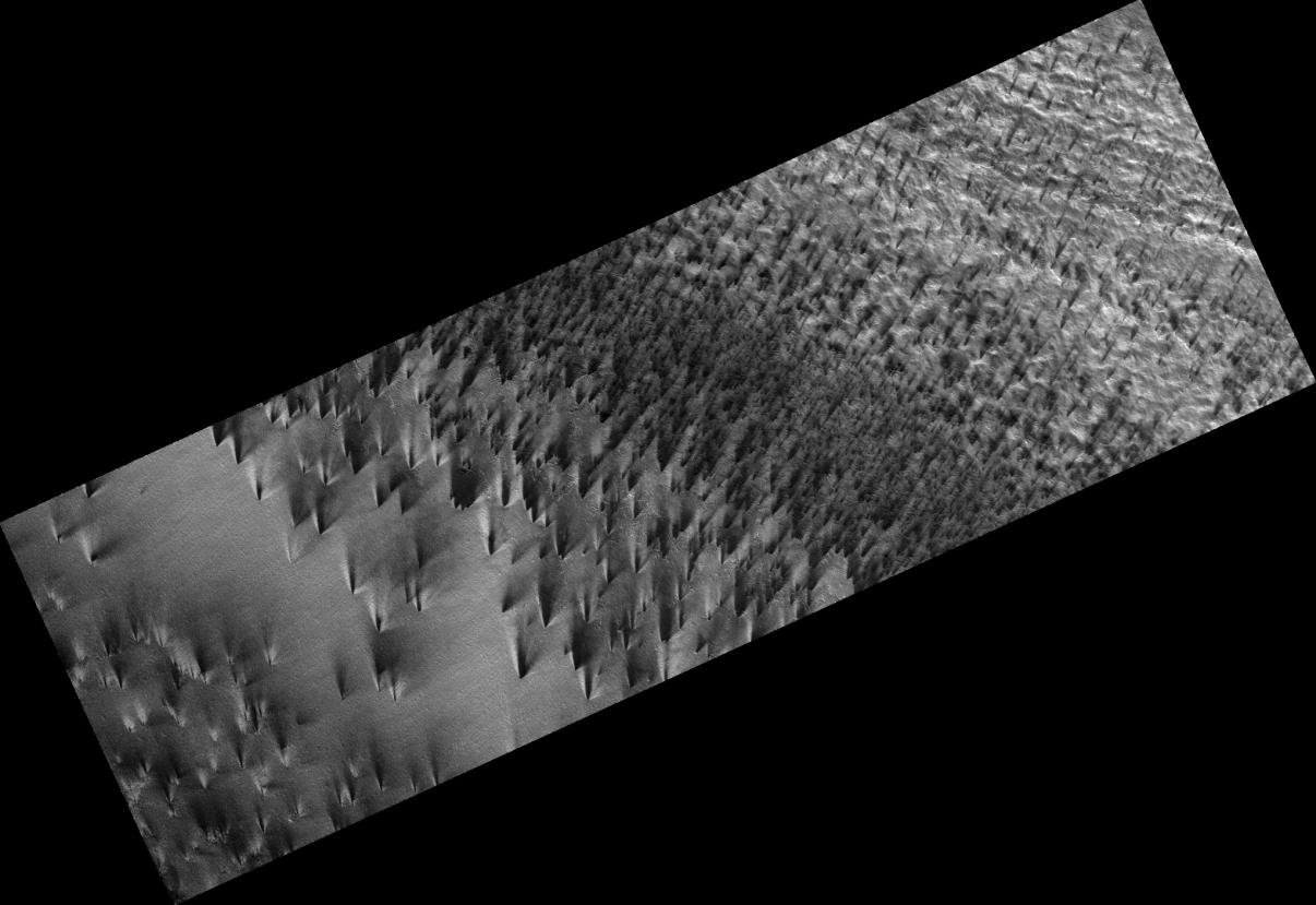
The south polar region of Mars is covered every year by a layer of carbon dioxide ice. In a region called the "cryptic terrain," the ice is translucent and sunlight can penetrate through the ice to warm the surface below.
The ice layer sublimates (evaporates) from the bottom. The dark fans of dust seen in this image come from the surface below the layer of ice, carried to the top by gas venting from below. The translucent ice is "visible" by virtue of the effect it has on the tone of the surface below, which would otherwise have the same color and reflectivity as the fans.
Bright streaks in this image are fresh frost. The CRISM team has identified the composition of these streaks to be carbon dioxide.
Observation Geometry
Image PSP_003113_0940 was taken by the High Resolution Imaging Science Experiment (HiRISE) camera onboard the Mars Reconnaissance Orbiter spacecraft on 26-Mar-2007. The complete image is centered at -85.8 degrees latitude, 106.0 degrees East longitude. The range to the target site was 244.9 km (153.0 miles). At this distance the image scale is 49.0 cm/pixel (with 2 x 2 binning) so objects ~147 cm across are resolved. The image shown here has been map-projected to 50 cm/pixel . The image was taken at a local Mars time of 06:20 PM and the scene is illuminated from the west with a solar incidence angle of 79 degrees, thus the sun was about 11 degrees above the horizon. At a solar longitude of 207.6 degrees, the season on Mars is Northern Autumn.
NASA's Jet Propulsion Laboratory, a division of the California Institute of Technology in Pasadena, manages the Mars Reconnaissance Orbiter for NASA's Science Mission Directorate, Washington. Lockheed Martin Space Systems, Denver, is the prime contractor for the project and built the spacecraft. The High Resolution Imaging Science Experiment is operated by the University of Arizona, Tucson, and the instrument was built by Ball Aerospace and Technology Corp., Boulder, Colo.
 Planetary Data System


