
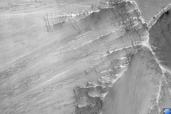
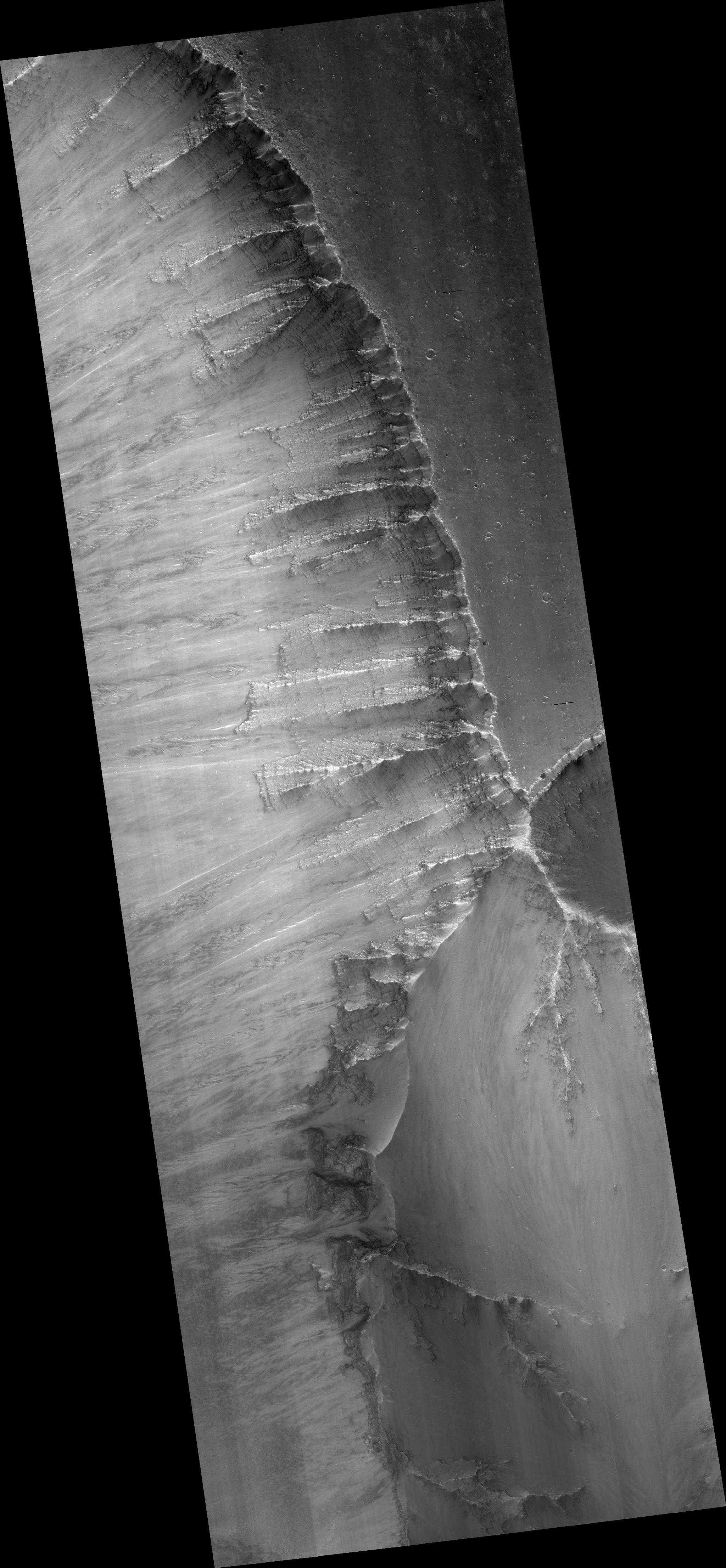
Click on image for larger versionThis HiRISE image (PSP_004858_1670) shows a landslide scarp on the northern wall of central Valles Marineris, a large canyon system equivalent in length from California to New York.
The landslide has exposed a fresh wall of the canyon so that individual layers of rock can be seen. The texture of these layers suggests that some of the darker rock layers are more resistant to erosion than the lighter layers. The variation in brightness and friability of the different layers suggests compositional differences. These layers may have a volcanic origin, having been deposited as ash layers, or a sedimentary origin, either being deposited by water or blown by the wind (aeolian).
This image is a little hazy because this image was taken in August 2007, when the large dust storm covered the surface of Mars and filled the atmosphere with fine dust particles. The extra dust in the atmosphere reflects more light into the camera.
Observation Toolbox
Acquisition date: 8 August 2007
Local Mars time: 2:31 PM
Degrees latitude (centered): -12.8°
Degrees longitude (East): 301.1°
Range to target site: 259.8 km (162.4 miles)
Original image scale range: 26.0 cm/pixel (with 1 x 1 binning) so objects ~78 cm across are resolved
Map-projected scale: 25 cm/pixel and north is up
Map-projection: EQUIRECTANGULAR
Emission angle: 5.6°
Phase angle: 32.0°
Solar incidence angle: 37°, with the Sun about 53 ° above the horizon
Solar longitude: 292.6°, Northern Winter
NASA's Jet Propulsion Laboratory, a division of the California Institute of Technology in Pasadena, manages the Mars Reconnaissance Orbiter for NASA's Science Mission Directorate, Washington. Lockheed Martin Space Systems, Denver, is the prime contractor for the project and built the spacecraft. The High Resolution Imaging Science Experiment is operated by the University of Arizona, Tucson, and the instrument was built by Ball Aerospace and Technology Corp., Boulder, Colo.
