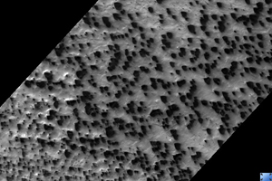
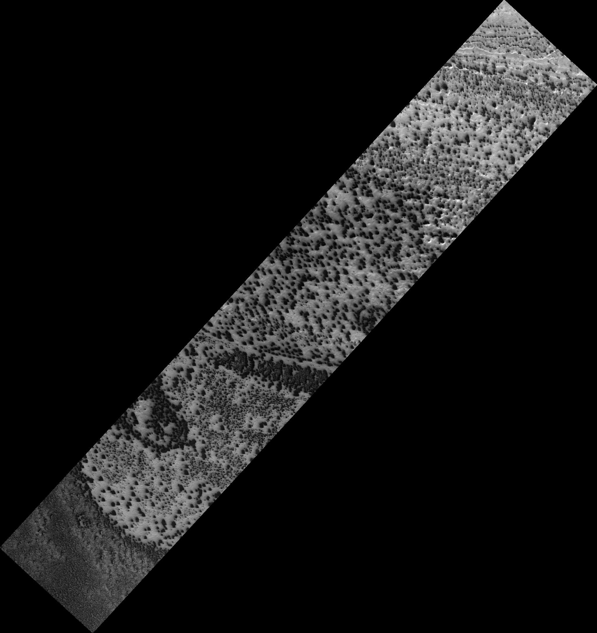
Click on image for larger versionSouthern spring sunshine is causing the seasonal carbon dioxide cap at the south pole to evaporate. This process happens fitfully, as small and large spots expose bare ground, which warms up, causing small spots to grow.
The defrosting areas are controlled by small scale differences in topography, which cause some areas of frost to be sheltered longer than others. Once dust has accessed the surface it is blown in directions controlled by the local winds, making a distinctive fan. When the wind changes direction the fans broaden or may show multiple orientations.
It has also been proposed that dust is carried to the top of translucent seasonal carbon dioxide ice by release of gas held under pressure by the ice cap. When the pressure is released, like pulling the cork out of a champagne bottle, the gas escapes, carrying dust with it.
This is HiRISE image PSP_003193_0850.
Observation Toolbox
Acquisition date: 4 April 2007
Local Mars time: 12:49 AM
Degrees latitude (centered): -85.2°
Degrees longitude (East): 180.0°
Range to target site: 248.1 km (155.0 miles)
Original image scale range: 49.6 cm/pixel (with 2 x 2 binning) so objects ~149 cm across are resolved
Map-projected scale: 50 cm/pixel and north is up
Map-projection: POLAR STEREOGRAPHIC
Emission angle: 8.7°
Phase angle: 74.8°
Solar incidence angle: 82°, with the Sun about 8° above the horizon
Solar longitude: 211.4°, Northern Autumn
NASA's Jet Propulsion Laboratory, a division of the California Institute of Technology in Pasadena, manages the Mars Reconnaissance Orbiter for NASA's Science Mission Directorate, Washington. Lockheed Martin Space Systems, Denver, is the prime contractor for the project and built the spacecraft. The High Resolution Imaging Science Experiment is operated by the University of Arizona, Tucson, and the instrument was built by Ball Aerospace and Technology Corp., Boulder, Colo.
 Planetary Data System


