
Click on image for larger versionDuring the long dark night of Martian winter at the south pole, carbon dioxide (CO2) in its solid form (also known as "dry ice") accumulates and forms a seasonal polar cap.
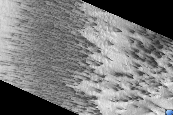
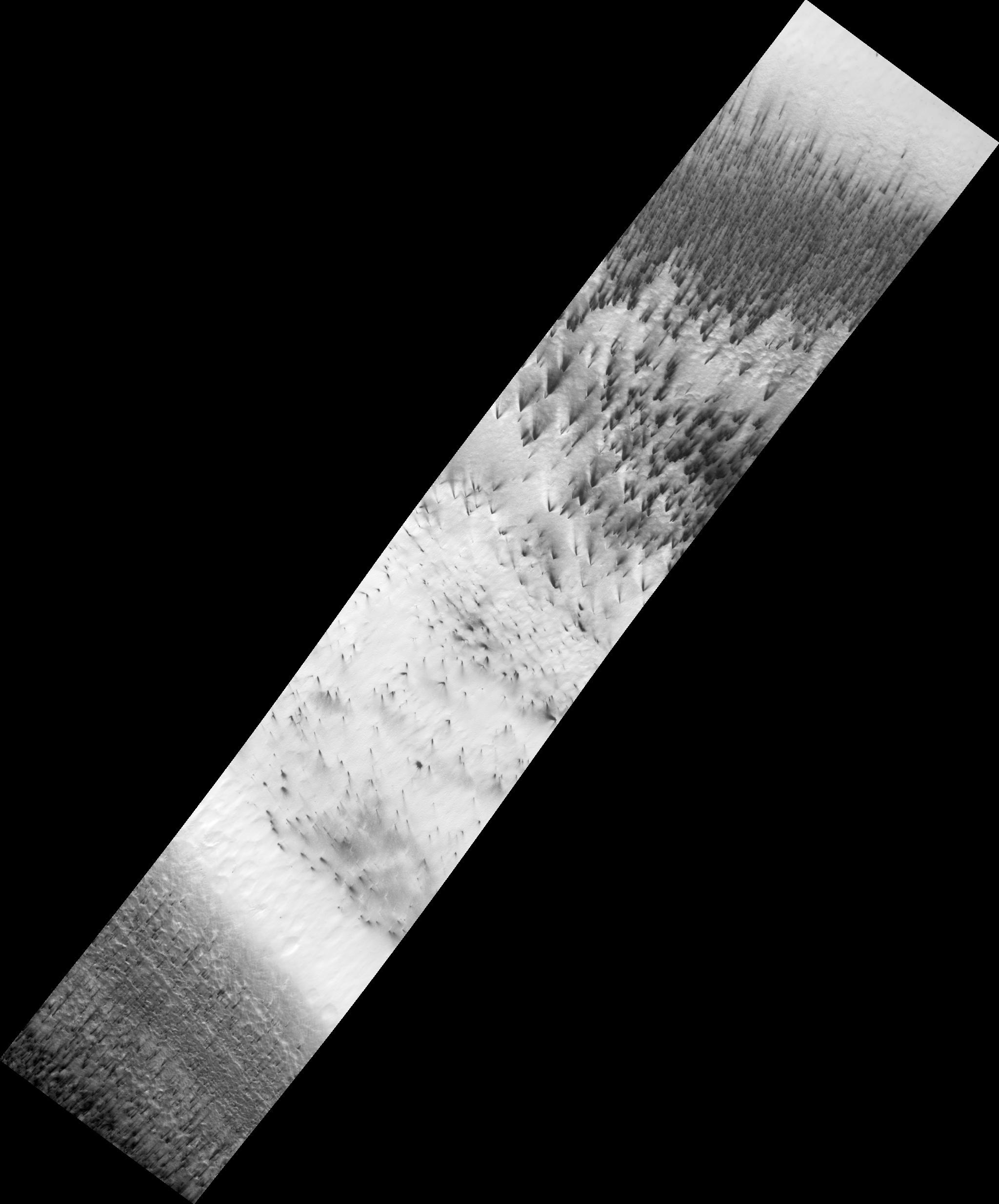
HiRISE is currently observing southern spring on Mars. As the sun comes up in the spring, the ice evaporates in a complex way. HiRISE image PSP_003180_0945 shows dark dust being blown across the seasonal south polar cap. The dust comes from the surface beneath the ice: it either starts at spots bare of ice, or it's possible that it's lofted from below the ice in geyser-like plumes.
Local winds blow the dust from its source, forming a long fan. When the wind changes direction, a new fan is formed, pointing in the new direction (see subimage 2; full resolution, approx. 800 meters [1/2 mile] across). In this single image we can see that the wind has blown in a number of directions (see subimage 1; not full resolution, approx. 4 km [2.5 miles] across). This data will be used to study weather patterns near the south pole.
Observation Toolbox
Acquisition date: 4 April 2007
Local Mars time: 8:08 PM
Degrees latitude (centered): -85.4°
Degrees longitude (East): 104.1°
Range to target site: 264.4 km (165.2 miles)
Original image scale range: 52.9 cm/pixel (with 2 x 2 binning) so objects ~159 cm across are resolved
Map-projected scale: 50 cm/pixel and north is up
Map-projection: POLAR STEREOGRAPHIC
Emission angle: 22.5°
Phase angle: 61.9°
Solar incidence angle: 80°, with the Sun about 10° above the horizon
Solar longitude: 210.8°, Northern Autumn
NASA's Jet Propulsion Laboratory, a division of the California Institute of Technology in Pasadena, manages the Mars Reconnaissance Orbiter for NASA's Science Mission Directorate, Washington. Lockheed Martin Space Systems, Denver, is the prime contractor for the project and built the spacecraft. The High Resolution Imaging Science Experiment is operated by the University of Arizona, Tucson, and the instrument was built by Ball Aerospace and Technology Corp., Boulder, Colo.
 Planetary Data System


