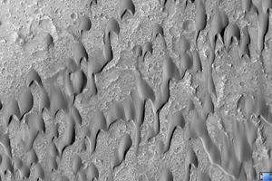
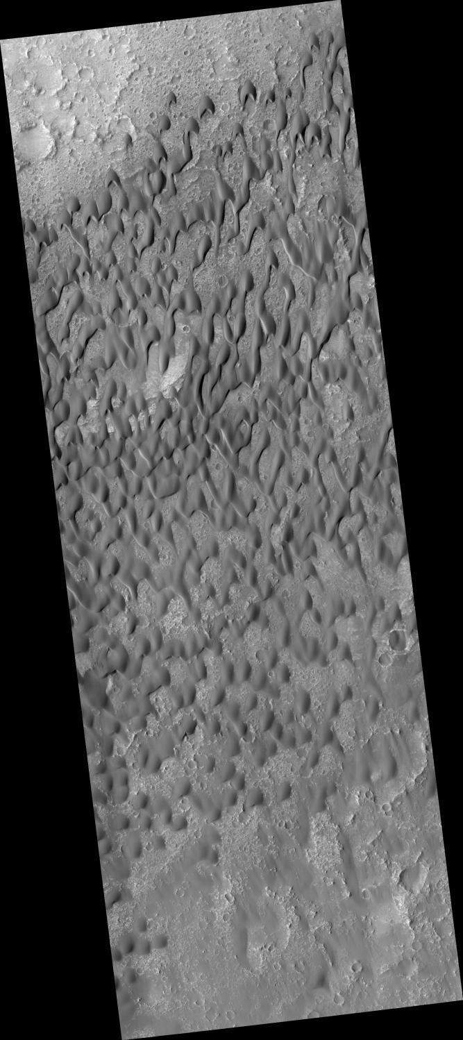
Click on image for larger versionHiRISE image PSP_002860_1650 shows part of the floor of Herschel Crater, a roughly 300 kilometer wide impact basin located in the southern cratered highlands of Mars.
The subimage is a close-up of a dark-toned sand dune field located on the crater floor. These dunes are "barchan" dunes, which are also commonly found on Earth. Barchan dunes are generally crescent-shaped, with their "horns" oriented in the downwind direction. They have a steep slip face (the downwind side of the dune).
Barchan dunes form by winds that blow mostly in one direction and thus are good indicators of the dominant wind direction. In this case, the strongest winds blow approximately north to south.
The surface of the dunes has a generally pitted and grooved texture and, in some places, is covered with smaller ripples. The grooved texture has led researchers in the past to believe the dune sands are "lithified," or cemented together. The rock that formed as a result has since been eroded and scoured by wind.
These dark dunes in Herschel Crater are most likely composed of basaltic sand.
Observation Toolbox
Acquisition date: 3 March 2007
Local Mars time: 3:44 PM
Degrees latitude (centered): -14.8°
Degrees longitude (East): 127.9°
Range to target site: 259.0 km (161.9 miles)
Original image scale range: 25.9 cm/pixel (with 1 x 1 binning) so objects ~78 cm across are resolved
Map-projected scale: 25 cm/pixel and north is up
Map-projection: EQUIRECTANGULAR
Emission angle: 2.3°
Phase angle: 57.9°
Solar incidence angle: 56°, with the Sun about 34° above the horizon
Solar longitude: 195.9°, Northern Autumn
NASA's Jet Propulsion Laboratory, a division of the California Institute of Technology in Pasadena, manages the Mars Reconnaissance Orbiter for NASA's Science Mission Directorate, Washington. Lockheed Martin Space Systems, Denver, is the prime contractor for the project and built the spacecraft. The High Resolution Imaging Science Experiment is operated by the University of Arizona, Tucson, and the instrument was built by Ball Aerospace and Technology Corp., Boulder, Colo.


