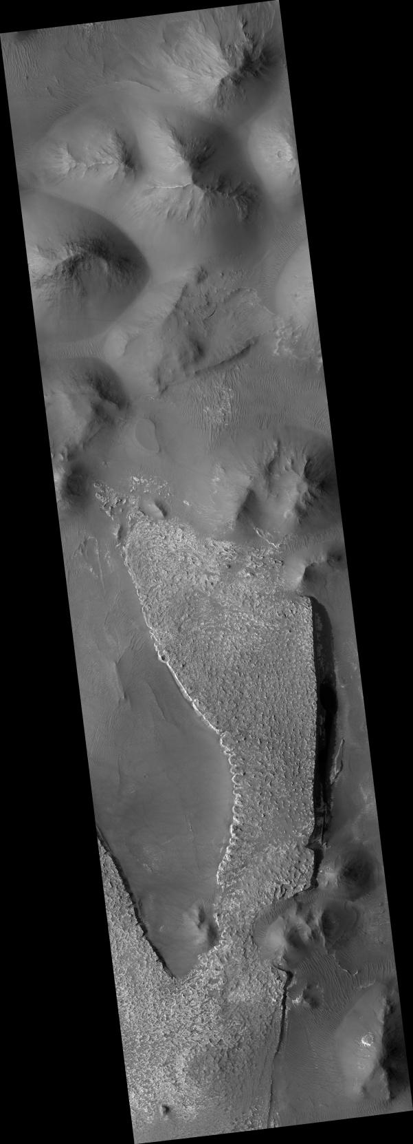
Click on image for larger versionThis HiRISE image (PSP_002892_1760) shows an outcrop of a large slab of layered deposits in Aureum Chaos.
"Chaotic" terrains on Mars are disorganized regions of blocks and large mounds which appear to have been produced by the collapse of pre-existing terrain. They are often associated with giant outflow channels, and they may have been the source of the water that carved the channels. This link is an important part of understanding the history of water on Mars. One way to address this is to study the rocks left behind in the chaotic terrains.
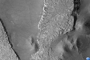
The outcrop in this image is several kilometers across and light-toned. It has a slab-like appearance, with relatively steep edges and a flat top, although the top has many small knobs and spires. In places (see subimage), particularly along the west (left) edge of the main slab, it is clear that the light material is composed of many fine layers, which are eroding in a stepped fashion due to the variable resistance of the layers. The flat surface of the outcrop is partially coated with dark dust, obscuring its light tone.
Along the edges, the outcrop is breaking into boulders and eroding away, but it is strong enough that it preserves steep slopes, particularly on the eastern edge.
Away from the large slab, the image consists of hills and mounds characteristic of chaotic terrain. Little detail is visible on the mounds. The low areas have been partially covered by wind-blown sand or dust, forming the pervasive ripples seen in the image. Light material can be seen under the ripples in a few places, indicating that the light layered deposits extend farther than just the slab.
Observation Toolbox
Acquisition date: 3 March 2007
Local Mars time: 3:42 PM
Degrees latitude (centered): -4.0°
Degrees longitude (East): 333.1°
Range to target site: 269.1 km (168.2 miles)
Original image scale range: 53.8 cm/pixel (with 2 x 2 binning) so objects ~162 cm across are resolved
Map-projected scale: 50 cm/pixel and north is up
Map-projection: EQUIRECTANGULAR
Emission angle: 0.0°
Phase angle: 55.5°
Solar incidence angle: 56°, with the Sun about 34° above the horizon
Solar longitude: 197.3°, Northern Autumn
NASA's Jet Propulsion Laboratory, a division of the California Institute of Technology in Pasadena, manages the Mars Reconnaissance Orbiter for NASA's Science Mission Directorate, Washington. Lockheed Martin Space Systems, Denver, is the prime contractor for the project and built the spacecraft. The High Resolution Imaging Science Experiment is operated by the University of Arizona, Tucson, and the instrument was built by Ball Aerospace and Technology Corp., Boulder, Colo.
