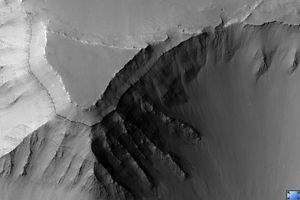
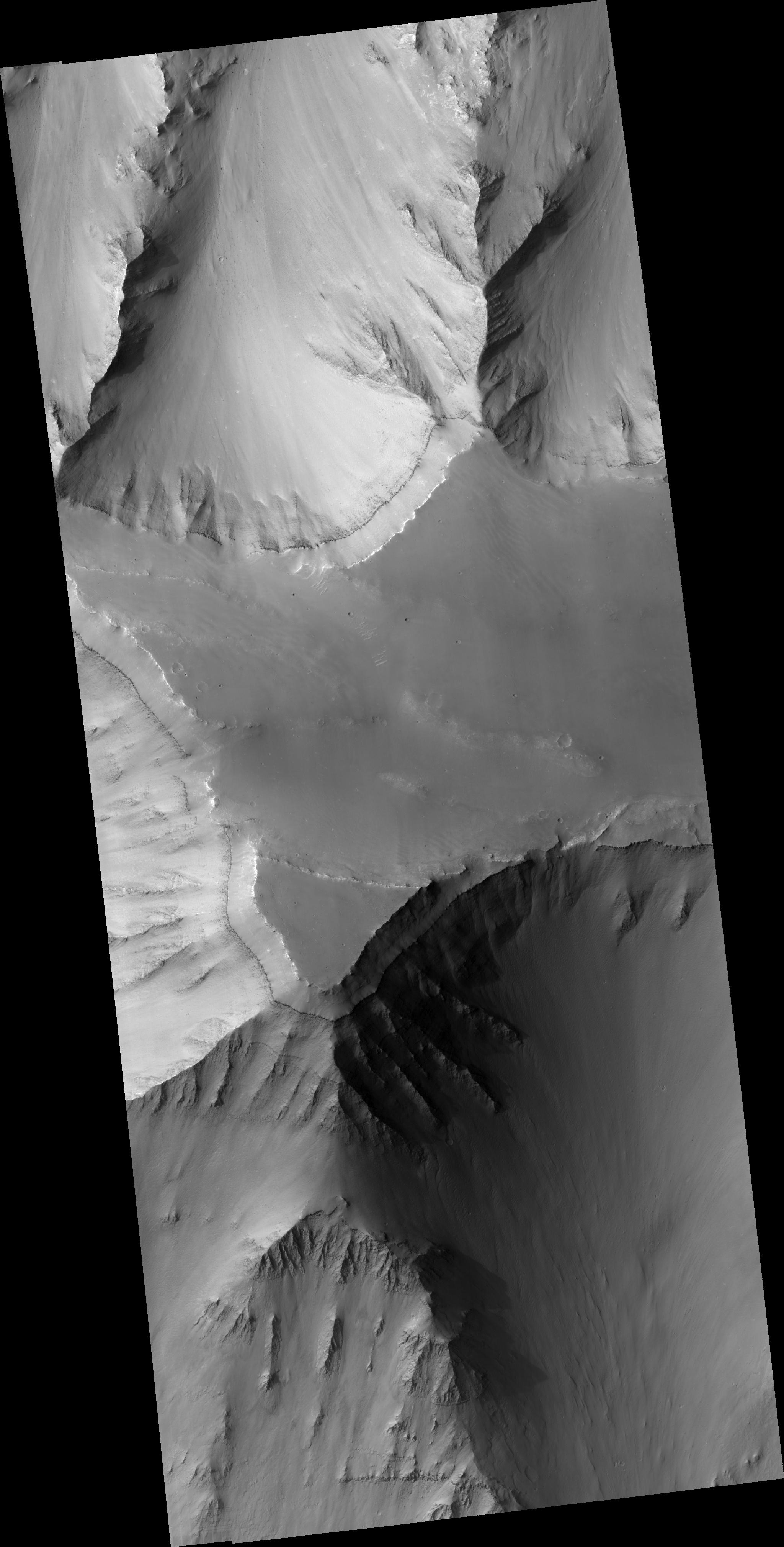
Click on image for larger versionThis HiRISE image (PSP_002036_1655) shows a mesa within Coprates Chasma, a large trough in the Valles Marineris canyon system. Multiple layers, some only a few meters in thickness, are visible on the slopes descending from the edges of the flat-topped mesa.
The layered rocks could have formed from volcanic, lacustrine, or aeolian sediments that were deposited in portions of the Valles Marineris trough. Variations in the brightness of the layers may represent compositional differences. In particular, the slopes contain a prominent layer of dark material that is seemingly composed of materials more resistant to erosion than the overlying brighter layers.
Dunes and ripples can also visible on the top of the mesa.
Observation Toolbox
Acquisition date: 1 January 2007
Local Mars time: 3:40 PM
Degrees latitude (centered): -14.4°
Degrees longitude (East): 304.2°
Range to target site: 258.8 km (161.7 miles)
Original image scale range: from 25.9 cm/pixel (with 1 x 1 binning) to 51.8 cm/pixel (with 2 x 2 binning)
Map-projected scale: 25 cm/pixel and north is up
Map-projection: EQUIRECTANGULAR
Emission angle: 2.3°
Phase angle: 61.4°
Solar incidence angle: 59°, with the Sun about 31° above the horizon
Solar longitude: 160.0°, Northern Summer
NASA's Jet Propulsion Laboratory, a division of the California Institute of Technology in Pasadena, manages the Mars Reconnaissance Orbiter for NASA's Science Mission Directorate, Washington. Lockheed Martin Space Systems, Denver, is the prime contractor for the project and built the spacecraft. The High Resolution Imaging Science Experiment is operated by the University of Arizona, Tucson, and the instrument was built by Ball Aerospace and Technology Corp., Boulder, Colo.

