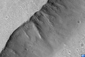
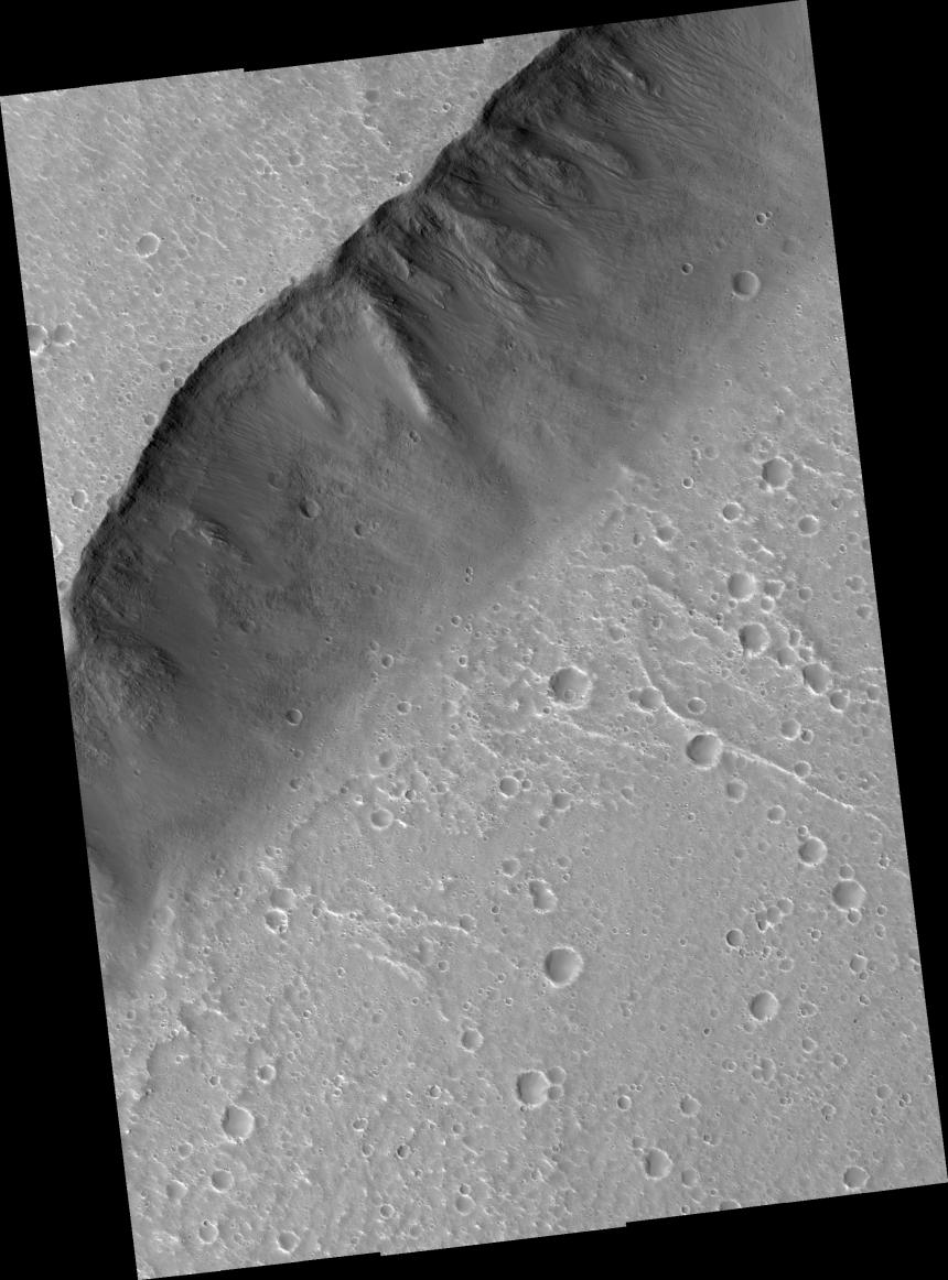
Click on image for larger versionThis HiRISE scene (PSP_001640_2125) shows the very steep side of a plateau, part of the northern limit of the Kasei Valles system, which is one of the largest outflow channel systems on Mars.
The difference in elevation here between the mostly flat channel's floor (bottom right) and the top of the plateau (top left) is over 1,300 m (0.8 miles), comparable in height to the Grand Canyon walls.
The Kasei Valles system is much wider than the Grand Canyon, though, getting to be in places 500 km (300 miles) wide. (The Grand Canyon's maximum width is 30 km, or 18 miles).
The image's subset (400 x 250 m or 440 x 270 yards) shows numerous paths with the appearance of dotted lines, criss-crossing the steep side of the plateau. The carving agents can be found at the end of some of these paths: rocky blocks such as the ones in this subset, up to 2 m (2.2 yards) across (4 m or 4.4 yards across elsewhere in the image).
Some of these blocks traveled downhill several hundred meters (yards) as they rolled and bounced leaving behind a trail of indentations or poke marks in the surface's fine-grained, light-toned soils. The raised borders in some of these poke marks indicate they are relatively recent features, unaffected by wind erosion, or that this soil has cohesive properties, such as if it was cemented.
The sound of these blocks falling did not travel very far, though. According to computer simulations sound in Mars travels only 1.5% the distance it would travel on Earth. (No Martian sound has ever been recorded.) Hence, the same sound which would travel 1 km (0.6 miles) on Earth would travel only 15 m (16 yards) on Mars. This is due to the lower Martian atmospheric pressure, which is approximately 1% of that of Earth.
Observation Toolbox
Acquisition date: 12 December 2006
Local Mars time: 3:25 PM
Degrees latitude (centered): 32.2°
Degrees longitude (East): 306.0°
Range to target site: 292.4 km (182.8 miles)
Original image scale range: from 29.3 cm/pixel (with 1 x 1 binning) to 58.5 cm/pixel (with 2 x 2 binning)
Map-projected scale: 25 cm/pixel and north is up
Map-projection: EQUIRECTANGULAR
Emission angle: 5.2°
Phase angle: 55.0°
Solar incidence angle: 50°, with the Sun about 40° above the horizon
Solar longitude: 144.1°, Northern Summer
NASA's Jet Propulsion Laboratory, a division of the California Institute of Technology in Pasadena, manages the Mars Reconnaissance Orbiter for NASA's Science Mission Directorate, Washington. Lockheed Martin Space Systems, Denver, is the prime contractor for the project and built the spacecraft. The High Resolution Imaging Science Experiment is operated by the University of Arizona, Tucson, and the instrument was built by Ball Aerospace and Technology Corp., Boulder, Colo.
 Planetary Data System


