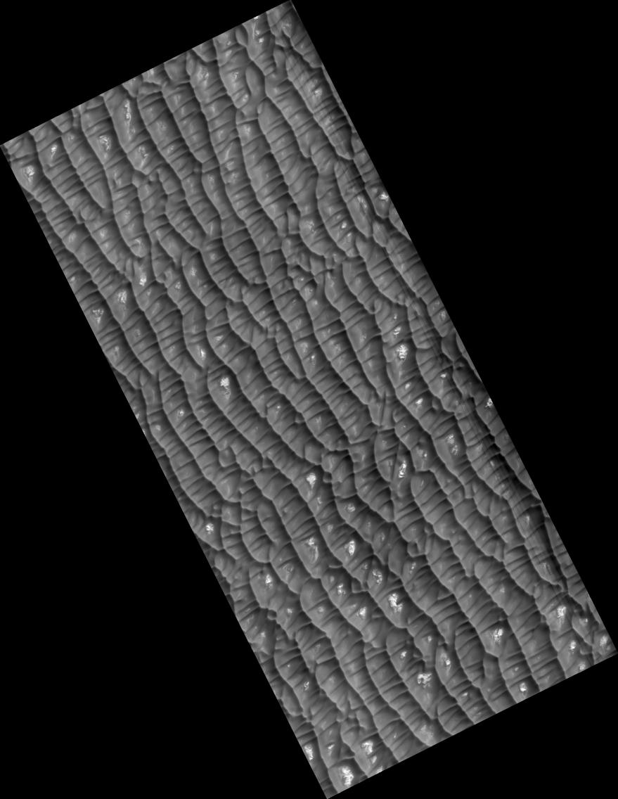
Click on image for larger versionThis HiRISE image (PSP_001736_2605) shows dark dunes and light polygonal terrain in Olympia Undae, also known as the North Polar Erg.
Two sets of dunes are obvious. The major set trends ~north-south, indicating winds from the east or west. Between the crests of these dunes is a second set oriented mostly east-west.
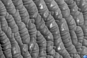
Zooming in on the dunes, a rippled texture is apparent, probably due to redistribution of sand at the scale of meters and less. Near the crests of some dunes are channel-like features, with some branching downslope. The origin of these channels is unknown, but they may result from the flow and displacement of sand that was fluidized by sublimating carbon dioxide or water frost.
Bright patches of ground are found in some inter-dune areas, with many having a polygonal texture. Polygons on Earth form from contraction induced by stresses from dehydration, cooling, and other processes, so these features may have a similar origin. The CRISM instrument on MRO and OMEGA on Mars Express indicates that many dunes in Olympia Undae are rich in the mineral gypsum.
Observation Toolbox
Acquisition date: 12 December 2006
Local Mars time: 2:37 PM
Degrees latitude (centered): 80.2°
Degrees longitude (East): 191.2°
Range to target site: 316.4 km (197.7 miles)
Original image scale range: 31.6 cm/pixel (with 1 x 1 binning) so objects ~95 cm across are resolved
Map-projected scale: 25 cm/pixel and north is up
Map-projection: POLAR STEREOGRAPHIC
Emission angle: 2.0°
Phase angle: 67.8°
Solar incidence angle: 69°, with the Sun about 21° above the horizon
Solar longitude: 147.9°, Northern Summer
NASA's Jet Propulsion Laboratory, a division of the California Institute of Technology in Pasadena, manages the Mars Reconnaissance Orbiter for NASA's Science Mission Directorate, Washington. Lockheed Martin Space Systems, Denver, is the prime contractor for the project and built the spacecraft. The High Resolution Imaging Science Experiment is operated by the University of Arizona, Tucson, and the instrument was built by Ball Aerospace and Technology Corp., Boulder, Colo.
 Planetary Data System


