Click on image for larger versionThe south polar layered deposits are a stack of layered ice up to 3000 meters (9800 feet) thick which is similar to terrestrial ice sheets. In places, this stack extends up to 1100 kilometers (680 miles) from the pole and many of the impact craters surrounding this ice-sheet appear to be filled with mounds of similar icy material and also sand dunes.
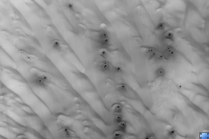
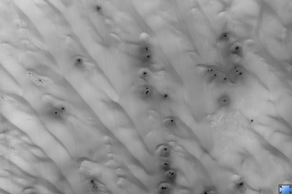
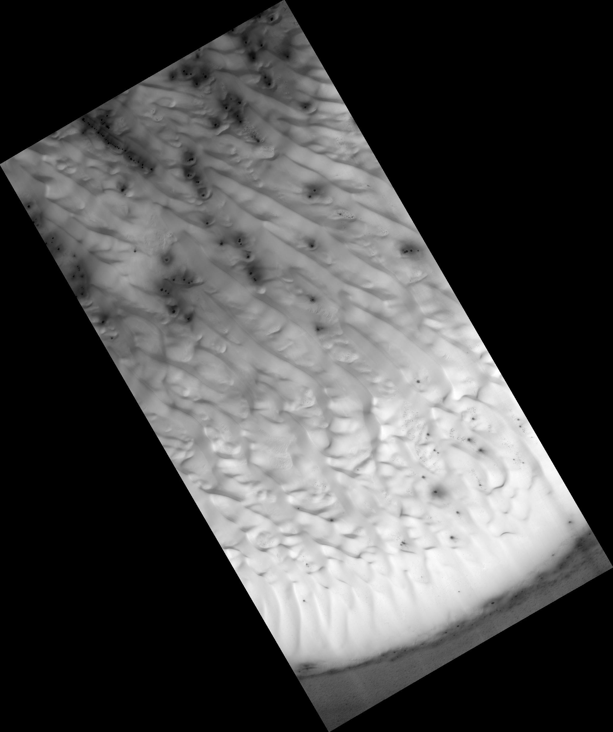
This image shows the material within one of these near-polar craters. The crater is about 44 kilometers (27 miles) across and contains a mound of material about 23 kilometers (14 miles) across and 300 meters (1000 feet) thick on its northern (south facing) wall. The dark material at the top (north) of the image shows the northern wall of the crater, the bright material that begins near the image top and extends toward the bottom is the surface of the mound.
This surface is covered with sand dunes that appear bright as they are still covered by seasonal carbon dioxide frost. Smaller dunes and ripples can be seen on the surfaces of the larger linear dunes. In the low lying areas between dunes, one can see a network of cracks that are reminiscent of the surface of the polar layered deposits, indicating that this mound is probably mostly ice with a thinner and incomplete covering of dunes.
The dark spots in the frost cover are characteristic of how this terrain defrosts, and are commonly observed in these locations during this season.
This HiRISE image is PSP_002345_1095.
Observation Toolbox
Acquisition date: 1 January 2007
Local Mars time: 10:00 PM
Degrees latitude (centered): -70.2°
Degrees longitude (East): 159.0°
Range to target site: 248.4 km (155.3 miles)
Original image scale range: 49.7 cm/pixel (with 2 x 2 binning) so objects ~149 cm across are resolved
Map-projected scale: 50 cm/pixel
Map-projection: POLAR STEREOGRAPHIC
Emission angle: 0.4°
Phase angle: 83.9°
Solar incidence angle: 84°, with the Sun about 6° above the horizon
Solar longitude: 173.0°, NNASA's Jet Propulsion Laboratory, a division of the California Institute of Technology in Pasadena, manages the Mars Reconnaissance Orbiter for NASA's Science Mission Directorate, Washington. Lockheed Martin Space Systems, Denver, is the prime contractor for the project and built the spacecraft. The High Resolution Imaging Science Experiment is operated by the University of Arizona, Tucson, and the instrument was built by Ball Aerospace and Technology Corp., Boulder, Colo.
 Planetary Data System


