 |  |
| Wind Speed | Wave Height |
Click on images for larger versions
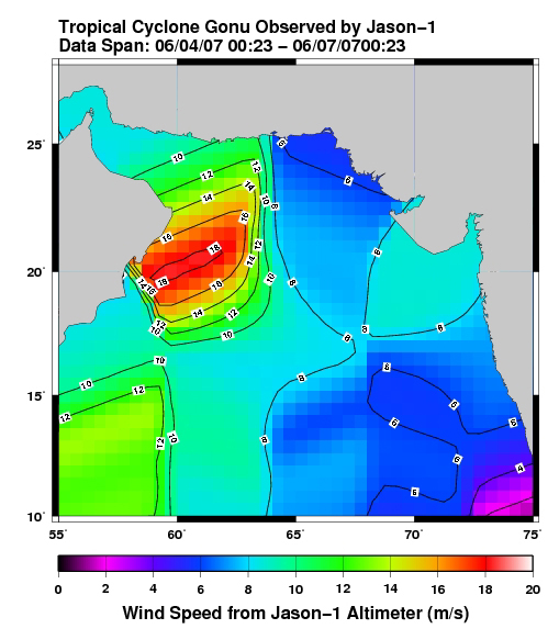
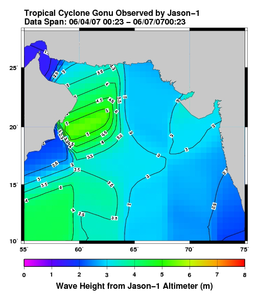
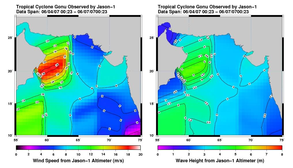
This pair of images from the radar altimeter instrument on the U.S./France Jason mission reveals information on wind speeds and wave heights of Tropical Cyclone Gonu, which reached Category 5 strength in the Arabian Sea prior to landfall in early June 2007. Strong winds near 20 meters per second and wave heights of greater than 5 meters were recorded. These high waves are extremely rare in the Arabian Sea and exacerbated heavy flooding from the storm surge over much of the Oman coastline.
The U.S. portion of the Jason mission is managed by JPL for NASA's Science Mission Directorate, Washington, D.C. Research on Earth's oceans using Jason and other space-based capabilities is conducted by NASA's Science Mission Directorate to better understand and protect our home planet.
