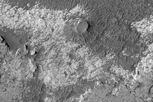
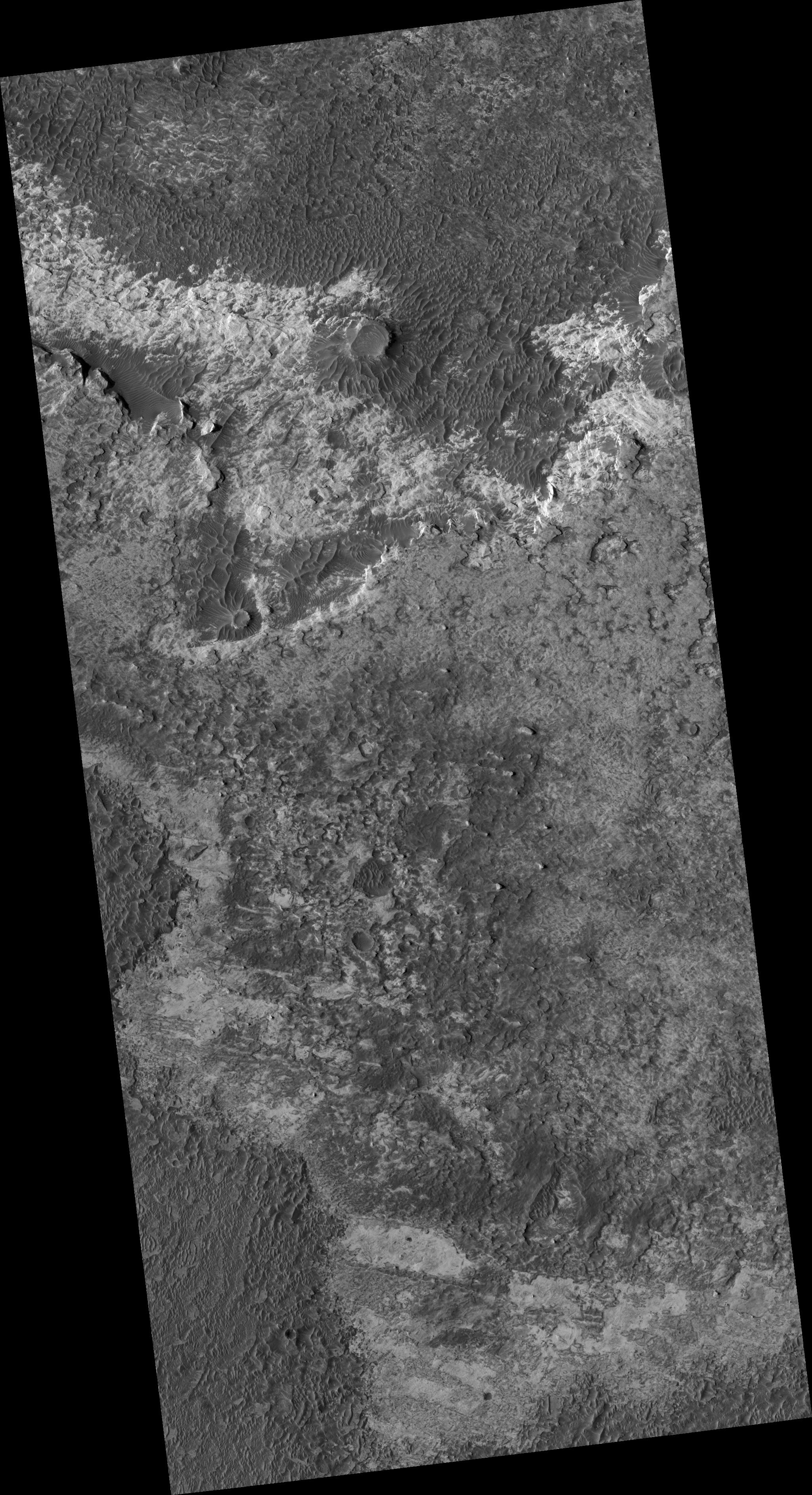
Click on image for larger versionThis HiRISE image (PSP_002324_1815) shows the contact between the Hematite Bearing Plains and Etched Terrain in Northern Meridiani Planum.
The Hematite Bearing Plains (exposed at the bottom left of this image) are dark, smooth and full of dune fields. This unit is laterally extensive and the same unit that the Mars Exploration Rover Opportunity is sitting on about 400 km to the southwest. Based on observations by Opportunity, this unit is interpreted to be a thin aeolian (wind-blown) mantle of basaltic sand and hematite concretions sitting on the Etched Terrain.
The Etched Terrain in this image is split into two units. The darker unit at the top of the image is filling in a ~120 km NW-SE trending valley, while the brighter Etched Terrain in the middle of the image is stratigraphically and topographically higher than the lower Etched Terrain in the valley. This upper Etched Terrain is a plateau-forming unit with a geomorphic pattern that ranges from relatively flat plains to dissected plateaus and mesas. The lower Etched Terrain is flat with low albedo, and covered in dunes.
It is in these Etched Terrains that CRISM, and previously OMEGA, have detected hydrated sulfates, which makes a sedimentary origin seems most likely for these layered deposits of Etched Terrain found in Meridiani.
Observation Geometry
Acquisition date: 1 January 2007
Local Mars time: 3:41 PM
Degrees latitude (centered): 1.6 °
Degrees longitude (East): 359.8 °
Range to target site: 271.2 km (169.5 miles)
Original image scale range: 27.1 cm/pixel (with 1 x 1 binning) so objects ~81 cm across are resolved
Map-projected scale: 25 cm/pixel and north is up
Map-projection: EQUIRECTANGULAR
Emission angle: 2.0 °
Phase angle: 53.4 °
Solar incidence angle: 55 °, with the Sun about 35 ° above the horizon
Solar longitude: 172.1 °, Northern Summer
NASA's Jet Propulsion Laboratory, a division of the California Institute of Technology in Pasadena, manages the Mars Reconnaissance Orbiter for NASA's Science Mission Directorate, Washington. Lockheed Martin Space Systems, Denver, is the prime contractor for the project and built the spacecraft. The High Resolution Imaging Science Experiment is operated by the University of Arizona, Tucson, and the instrument was built by Ball Aerospace and Technology Corp., Boulder, Colo.
 Planetary Data System


