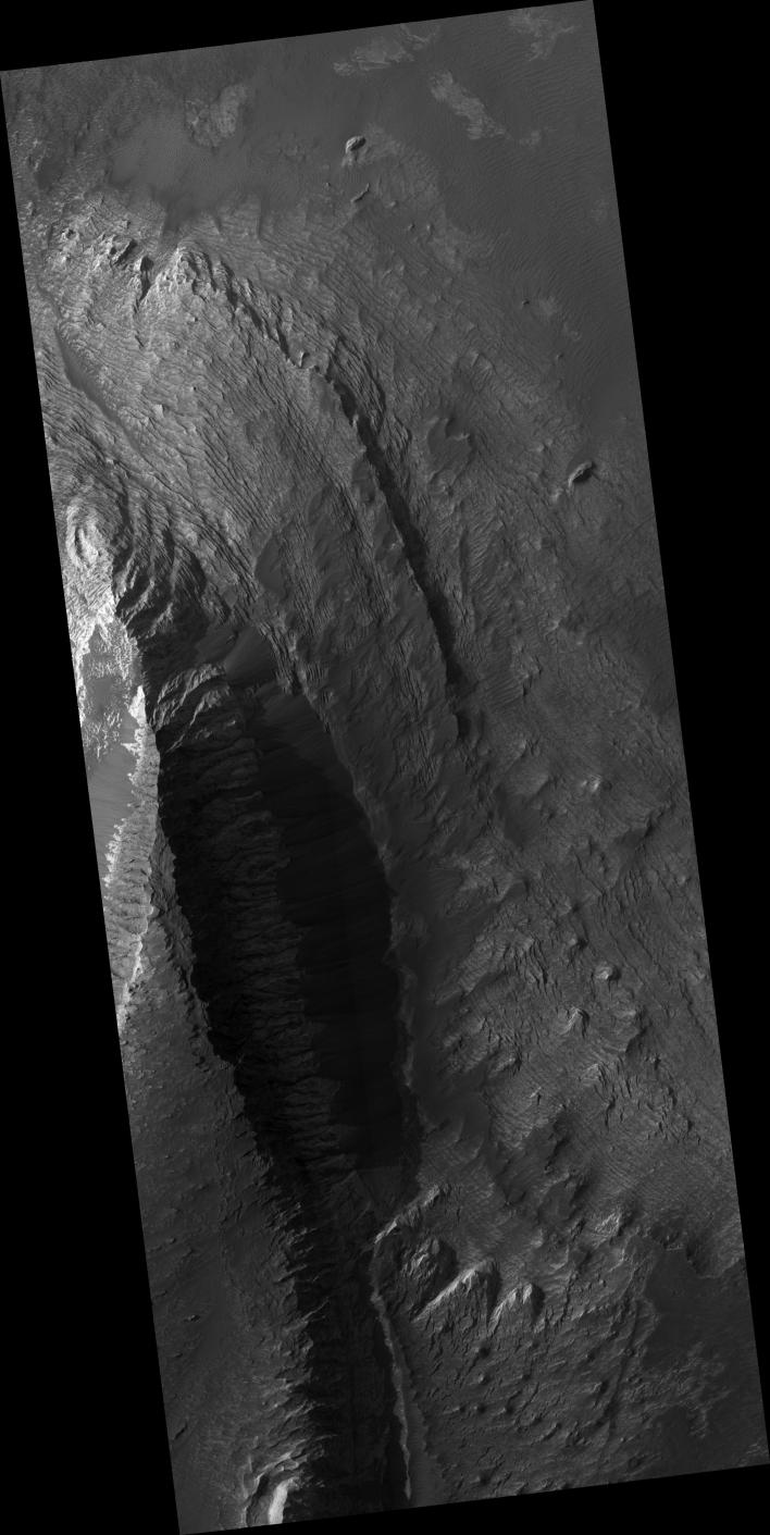
This HiRISE sub-image shows layering in a light-toned deposit in Melas Chasma.
The layers are sedimentary in origin, but there are many processes that could have deposited them, such as volcanic airfall from explosive eruptions, dust-size particles settling out of the atmosphere due to cyclic changes, and deposition in standing bodies of water.
By looking at the slopes in the layers and how the layers intersect each other, scientists can rule out various origins. A darker material can be seen covering much of the layered deposit. Some of this dark material is loose and can be seen accumulating as debris aprons at the base of steep slopes. Other dark material appears indurated and has been eroded by the wind to form etched edges with topographic expressions.
The lack of impact craters on the layered deposit indicates that it is a relatively young deposit, or the craters have been removed by the wind, or the deposit was quickly buried and is now being exhumed.
This HiRISE image is PSP_002419_1675.
Observation Geometry
Acquisition date: 1 January 2007
Local Mars time: 3:43 PM
Degrees latitude (centered): -11.4 °
Degrees longitude (East): 287.6 °
Range to target site: 263.5 km (164.7 miles)
Original image scale range: 26.4 cm/pixel (with 1 x 1 binning) so objects ~79 cm across are resolved
Map-projected scale: 25 cm/pixel and north is up
Map-projection: EQUIRECTANGULAR
Emission angle: 0.1 °
Phase angle: 57.1 °
Solar incidence angle: 57 °, with the Sun about 33 ° above the horizon
Solar longitude: 176.2 °, Northern Summer
NASA's Jet Propulsion Laboratory, a division of the California Institute of Technology in Pasadena, manages the Mars Reconnaissance Orbiter for NASA's Science Mission Directorate, Washington. Lockheed Martin Space Systems, Denver, is the prime contractor for the project and built the spacecraft. The High Resolution Imaging Science Experiment is operated by the University of Arizona, Tucson, and the instrument was built by Ball Aerospace and Technology Corp., Boulder, Colo.