
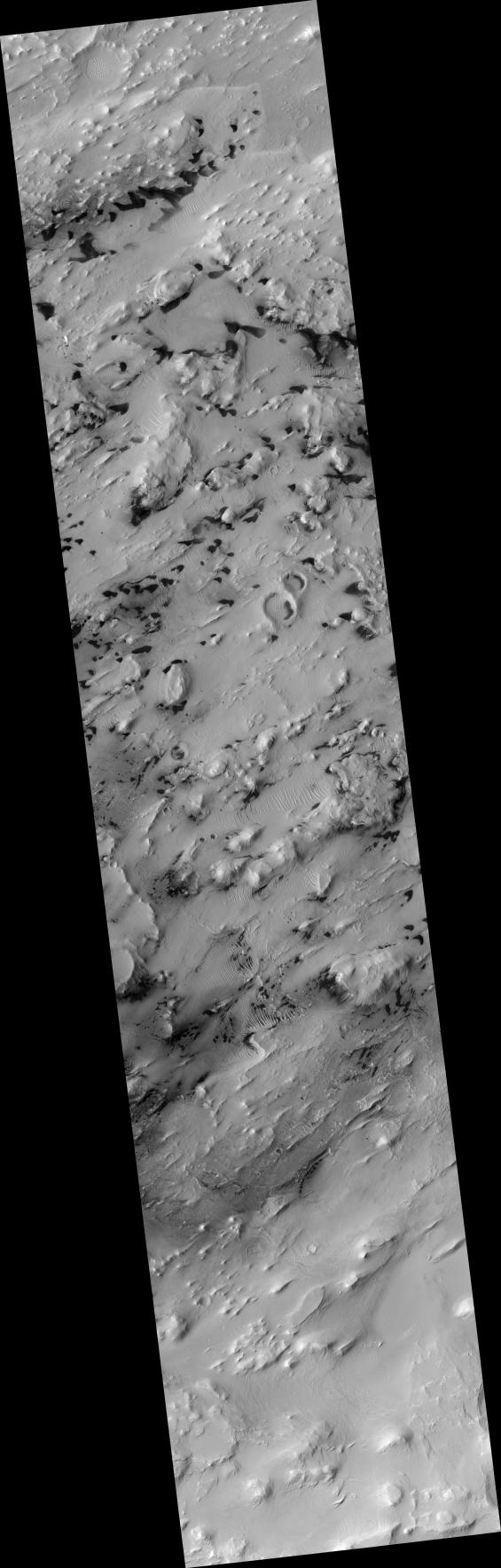
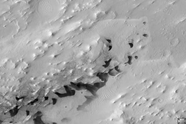
Click on image for larger versionThis HiRISE image (PSP_001756_1995) shows a portion of the central sedimentary deposits in Pasteur Crater.
These deposits are now being eroded into knobs and ridges. The erosion is probably dominated by wind, as most of the ridges are parallel. This is common in wind-eroded features, with the ridges generally aligned with the prevailing wind.
At high resolution, layering is revealed in many of the knobs and outcrops. The horizontal layers indicate that the material was deposited uniformly over a broad area. Possible origins include volcanic airfall or lacustrine (lake) deposits. After deposition, the rock in this area has been fractured and faulted, forming a diverse array of cracks.
The mottled appearance of much of the image is caused by dark, featureless patches which may be wind-blown dust. These have interacted with lighter-toned ridges and ripples which are probably also formed by eolian (wind) processes. In places, the dark patches partially cover the ripples, indicating that they have moved more recently, but they must be thin because the ripples frequently stand above surrounding dark material.
The ripples exhibit multiple interacting orientations in some places, producing networks of small ridges which reflect movement in winds from several directions.
Observation Geometry
Acquisition date: 12 December 2006
Local Mars time: 3:33 PM
Degrees latitude (centered): 19.2 °
Degrees longitude (East): 24.4 °
Range to target site: 283.7 km (177.3 miles)
Original image scale range: 56.8 cm/pixel(with 2 x 2 binning) so objects ~170 cm across are resolved
Map-projected scale: 50 cm/pixel and north is up
Map-projection: EQUIRECTANGULAR
Emission angle: 5.7 °br>Phase angle: 45.8 °
Solar incidence angle: 51 °, with the Sun about 39 ° above the horizon
Solar longitude: 148.6 °, Northern Summer
NASA's Jet Propulsion Laboratory, a division of the California Institute of Technology in Pasadena, manages the Mars Reconnaissance Orbiter for NASA's Science Mission Directorate, Washington. Lockheed Martin Space Systems, Denver, is the prime contractor for the project and built the spacecraft. The High Resolution Imaging Science Experiment is operated by the University of Arizona, Tucson, and the instrument was built by Ball Aerospace and Technology Corp., Boulder, Colo.
 Planetary Data System


