
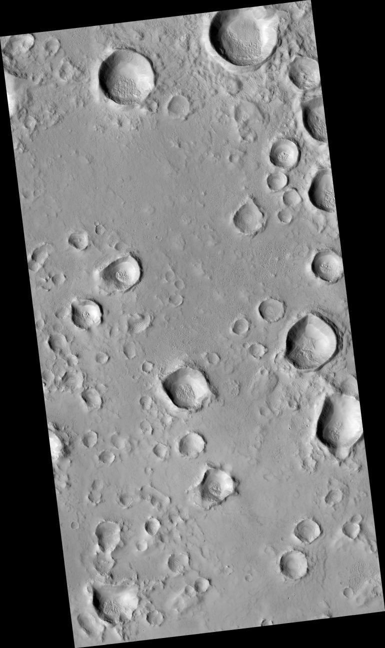
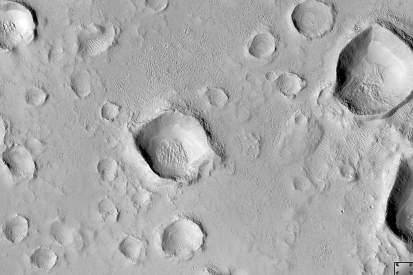
Click on image for larger versionThis HiRISE image (PSP_002281_2115) shows a secondary crater field. Secondary craters form when material ejected from a larger impact event impacts the Martian surface. One impact event, depending on the size of the impactor, can form hundreds of millions of secondary craters at essentially the same time.
Primary craters (those created directly from an impactor from space) can be the same size as secondary craters, which makes dating surfaces based on the number of accumulated craters difficult to near-impossible. Secondary craters are distinguished from primaries based on their morphologies. They are sometimes irregularly shaped, as seen in this image, because they form at relatively low velocities. The velocity of the impactor determines a crater's size, shape, and depth, with lower energy impacts forming shallow, less-developed craters and higher energy impacts forming deeper, more regular craters.
Secondary craters often occur in clusters, as seen here, as a piece of ejecta breaks up before hitting the surface. Primary craters form at random locations globally. Secondary clusters are more likely to be found in groups because of their formation mechanism.
Observation Geometry
Acquisition date: 1 January 2007
Local Mars time: 3:34 PM
Degrees latitude (centered): 31.1 °
Degrees longitude (East): 89.7 °
Range to target site: 291.1 km (181.9 miles)
Original image scale range: 29.1 cm/pixel(with 1 x 1 binning) so objects ~87 cm across are resolved
Map-projected scale: 25 cm/pixel and north is up
Map-projection: EQUIRECTANGULAR
Emission angle: 0.2 °
Phase angle: 57.1 °
Solar incidence angle: 57 °, with the Sun about 33 ° above the horizon
Solar longitude: 170.2 °, Northern Summer
NASA's Jet Propulsion Laboratory, a division of the California Institute of Technology in Pasadena, manages the Mars Reconnaissance Orbiter for NASA's Science Mission Directorate, Washington. Lockheed Martin Space Systems, Denver, is the prime contractor for the project and built the spacecraft. The High Resolution Imaging Science Experiment is operated by the University of Arizona, Tucson, and the instrument was built by Ball Aerospace and Technology Corp., Boulder, Colo.
 Planetary Data System


