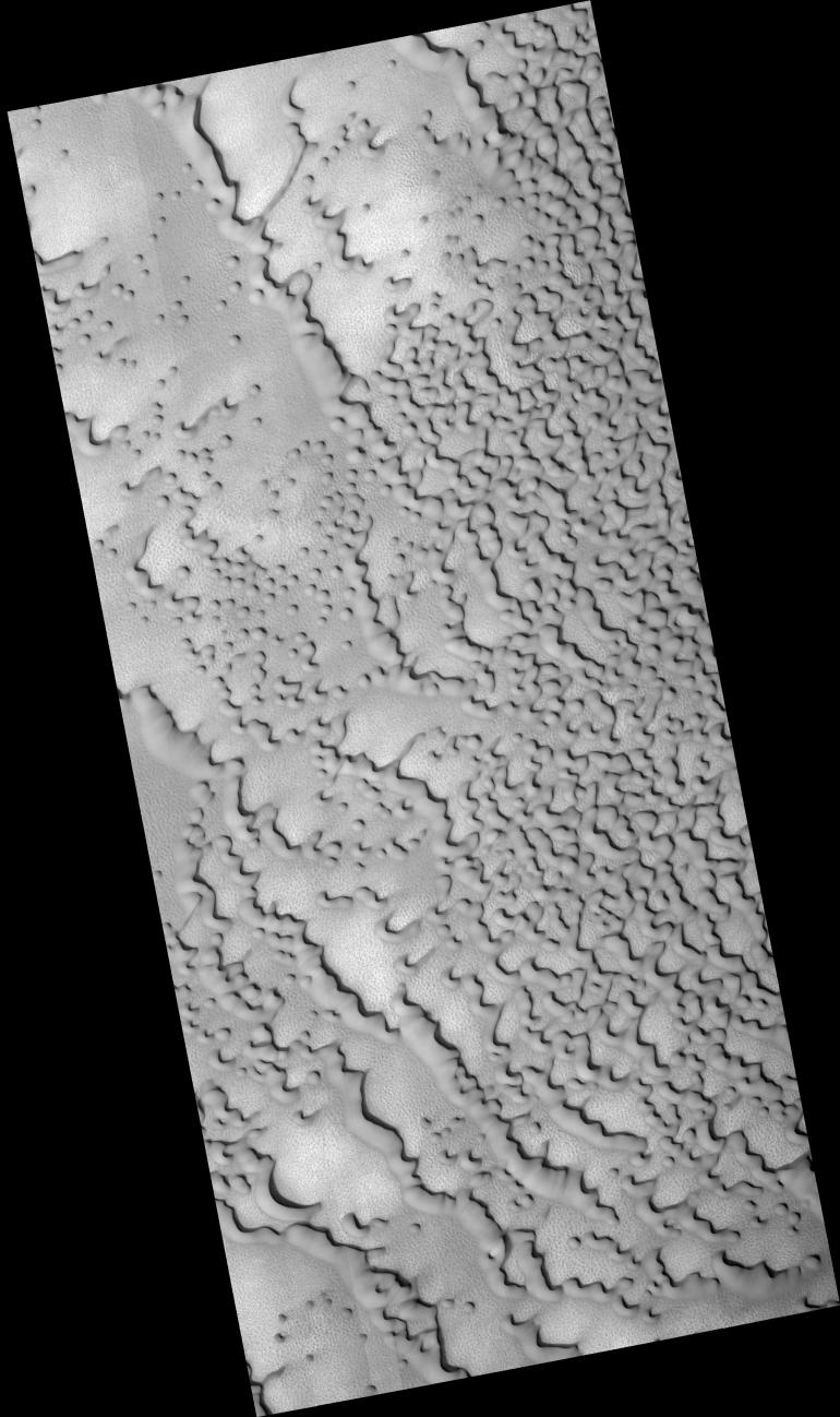
This HiRISE image shows dunes on the northern plains of Mars, and appears similar to images taken when the surface was covered by frost.
However, CRISM spectra taken at the same time do not show evidence for either water or carbon dioxide frost here. Possibly, and consistent with the CRISM spectra, this area is covered by dust, obscuring the dark material that is typically present in dunes of this type.
The orientation of the dunes indicates that they were formed by winds blowing generally from upper right to lower left. Ripples on the dunes show that the wind patterns that formed them are more complex, with the dune shapes affecting the wind direction.
It is not known whether these dunes are currently active (being moved by wind today) or have been in this location for a very long time, but if they are indeed covered by dust they cannot have been recently active.
Between the dunes, the underlying surface of the northern plains can be seen. In places, it has been fractured into polygonal blocks, suggesting that water ice is or was present below the surface. Meter-size blocks are also seen in places in this image and elsewhere on the northern plains. The origin of these blocks is not known, but they may be remnants of erosion of material that once covered this region.
Observation Geometry
Image PSP_001660_2570 was taken by the High Resolution Imaging Science Experiment (HiRISE) camera onboard the Mars Reconnaissance Orbiter spacecraft on 03-Dec-2006. The complete image is centered at 76.7 degrees latitude, 109.6 degrees East longitude. The range to the target site was 316.8 km (198.0 miles). At this distance the image scale is 63.4 cm/pixel (with 2 x 2 binning) so objects ~190 cm across are resolved. The image shown here has been map-projected to 50 cm/pixel . The image was taken at a local Mars time of 02:56 PM and the scene is illuminated from the west with a solar incidence angle of 66 degrees, thus the sun was about 24 degrees above the horizon. At a solar longitude of 144.9 degrees, the season on Mars is Northern Summer.
NASA's Jet Propulsion Laboratory, a division of the California Institute of Technology in Pasadena, manages the Mars Reconnaissance Orbiter for NASA's Science Mission Directorate, Washington. Lockheed Martin Space Systems, Denver, is the prime contractor for the project and built the spacecraft. The High Resolution Imaging Science Experiment is operated by the University of Arizona, Tucson, and the instrument was built by Ball Aerospace and Technology Corp., Boulder, Colo.
 Planetary Data System


