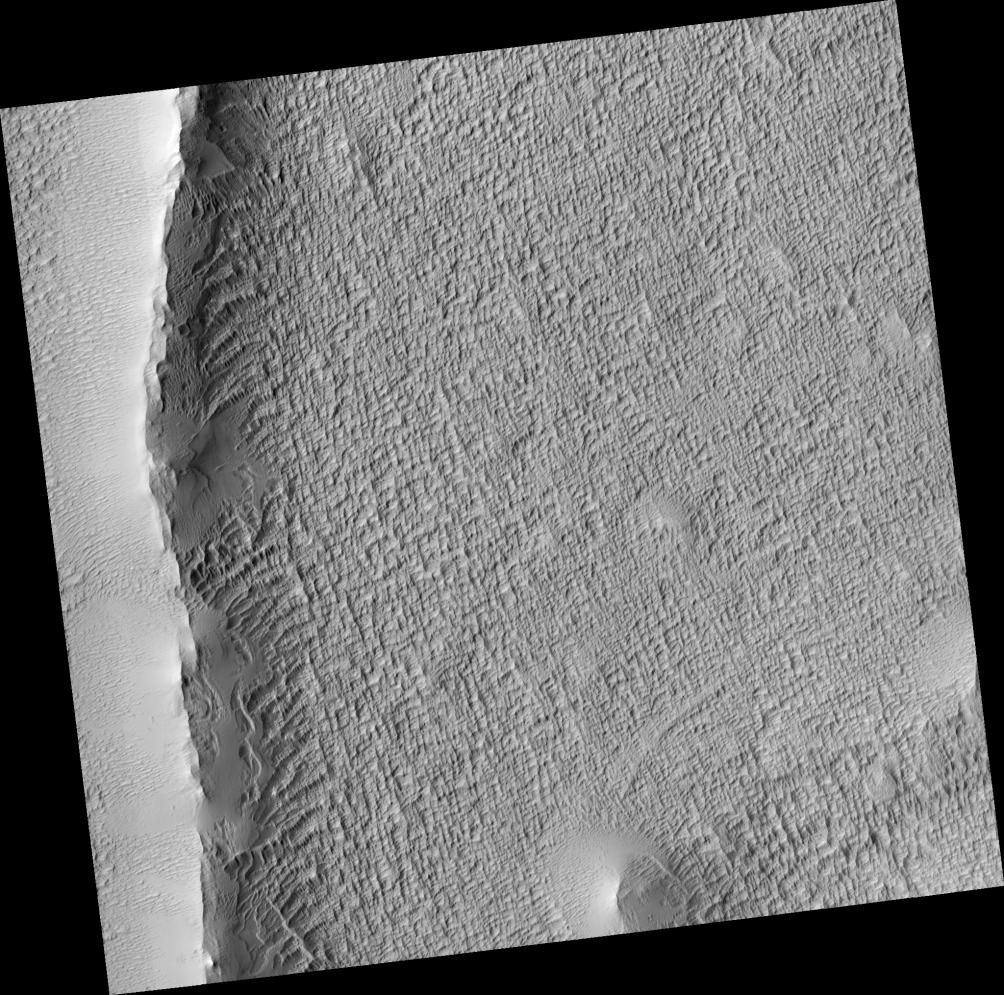
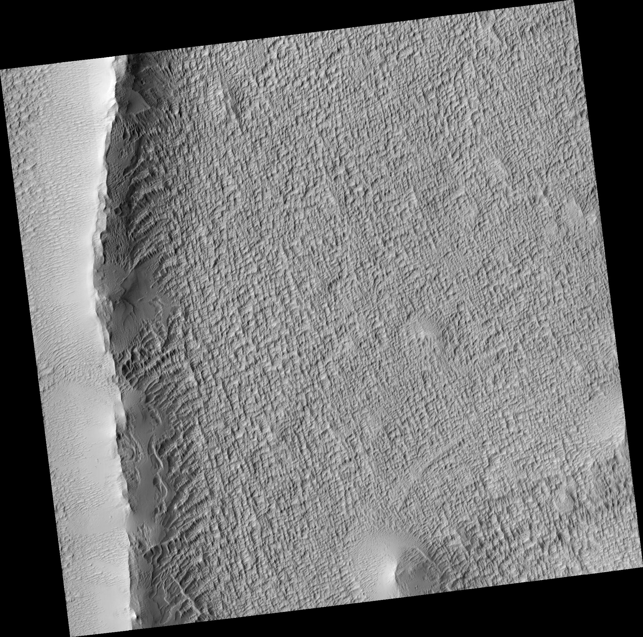
This HiRISE image shows an enigmatic ridge within a broad deposit west of Pavonis Mons, oriented roughly radial to the volcano.
The origin of the deposit is uncertain; one possibility is that it formed during an episode of cold-based glaciation in a different Martian climate. In other areas (outside the region shown here) it forms a series of arcuate concentric ridges which may be moraines. The textured appearance shown here of the surface is common in much of the deposit.
The large ridge in the left part of the image appears to have trapped some dust, as it has a smooth, mantled appearance. There are also many wind-blown ripples in the western part of the image. The ridge itself may be due to a volcanic eruption along a fissure system, possibly under ice if Pavonis Mons was once glaciated.
Unfortunately, the mantling at this site has obscured most underlying details of the ridge which could clarify the conditions under which it formed.
Observation Geometry
Image PSP_001682_1845 was taken by the High Resolution Imaging Science Experiment (HiRISE) camera onboard the Mars Reconnaissance Orbiter spacecraft on 05-Dec-2006. The complete image is centered at 4.3 degrees latitude, 244.8 degrees East longitude. The range to the target site was 265.1 km (165.7 miles). At this distance the image scale is 53.1 cm/pixel (with 2 x 2 binning) so objects ~159 cm across are resolved. The image shown here has been map-projected to 50 cm/pixel and north is up. The image was taken at a local Mars time of 03:35 PM and the scene is illuminated from the west with a solar incidence angle of 54 degrees, thus the sun was about 36 degrees above the horizon. At a solar longitude of 145.7 degrees, the season on Mars is Northern Summer.
NASA's Jet Propulsion Laboratory, a division of the California Institute of Technology in Pasadena, manages the Mars Reconnaissance Orbiter for NASA's Science Mission Directorate, Washington. Lockheed Martin Space Systems, Denver, is the prime contractor for the project and built the spacecraft. The High Resolution Imaging Science Experiment is operated by the University of Arizona, Tucson, and the instrument was built by Ball Aerospace and Technology Corp., Boulder, Colo.