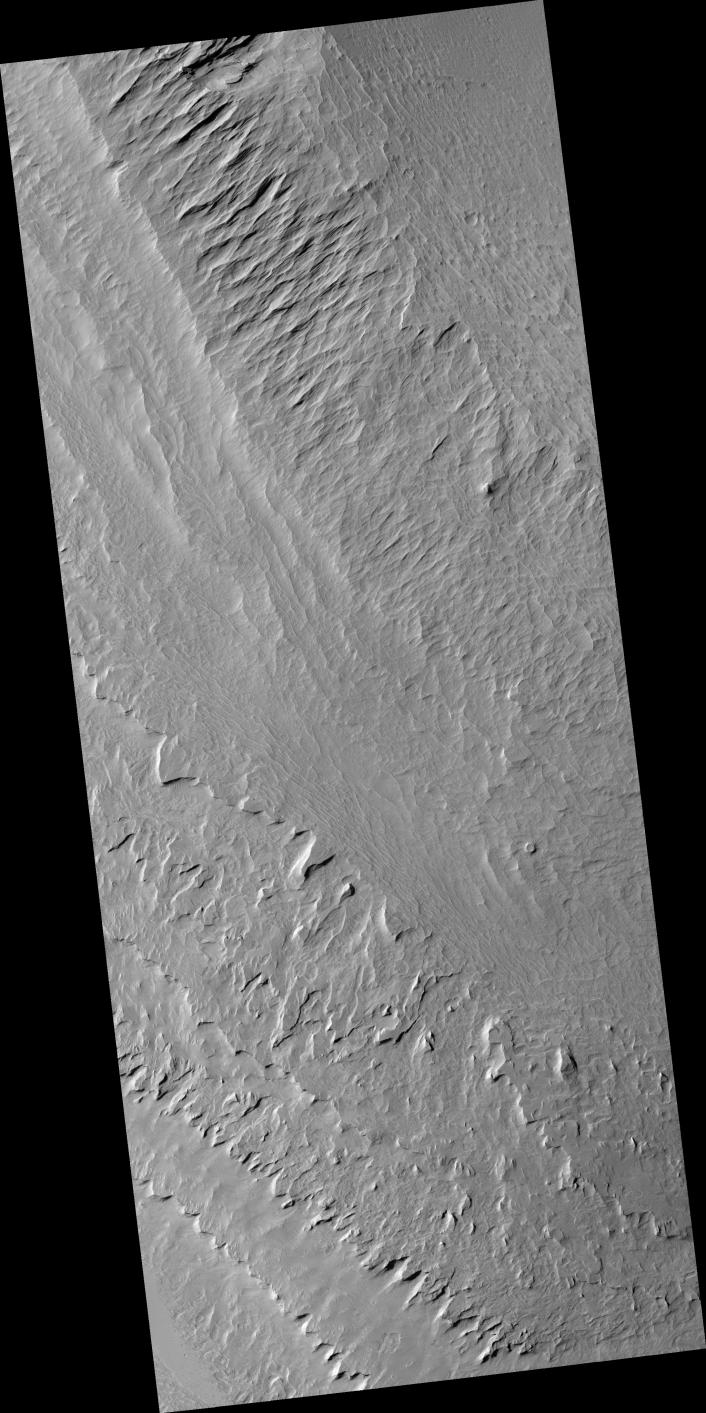
This image shows a portion of the central mound in the impact crater Gale that is of interest to scientists because it is composed of light-toned layered deposits. The layered deposits could have formed in a water environment if a lake once filled the crater. Alternatively, particles suspended in the atmosphere, such as dust or volcanic ash, could have built up the layers over time. By using HiRISE images to see details in the layers, such as how their thicknesses vary horizontally and vertically, scientists can narrow down the potential origins. The paucity of impact craters on the layered deposits indicates that either the deposits are very young, or more likely that they are being eroded to remove these craters. Wind erosion has modified the layers after they formed, creating both sharp corners and rounded depressions along the surface. Meter-size boulders can be seen at the base of steep cliffs, but the scarcity of boulders elsewhere suggests most of the erosion is occurring by the wind rather than downslope movement of material.
Image PSP_001422_1750 was taken by the High Resolution Imaging Science Experiment (HiRISE) camera onboard the Mars Reconnaissance Orbiter spacecraft on November 15, 2006. The complete image is centered at -5.0 degrees latitude, 137.7 degrees East longitude. The range to the target site was 262.1 km (163.8 miles). At this distance the image scale is 26.2 cm/pixel (with 1 x 1 binning) so objects ~79 cm across are resolved. The image shown here has been map-projected to 25 cm/pixel and north is up. The image was taken at a local Mars time of 3:31 PM and the scene is illuminated from the west with a solar incidence angle of 57 degrees, thus the sun was about 33 degrees above the horizon. At a solar longitude of 135.6 degrees, the season on Mars is Northern Summer.
NASA's Jet Propulsion Laboratory, a division of the California Institute of Technology in Pasadena, manages the Mars Reconnaissance Orbiter for NASA's Science Mission Directorate, Washington. Lockheed Martin Space Systems, Denver, is the prime contractor for the project and built the spacecraft. The High Resolution Imaging Science Experiment is operated by the University of Arizona, Tucson, and the instrument was built by Ball Aerospace and Technology Corp., Boulder, Colo.