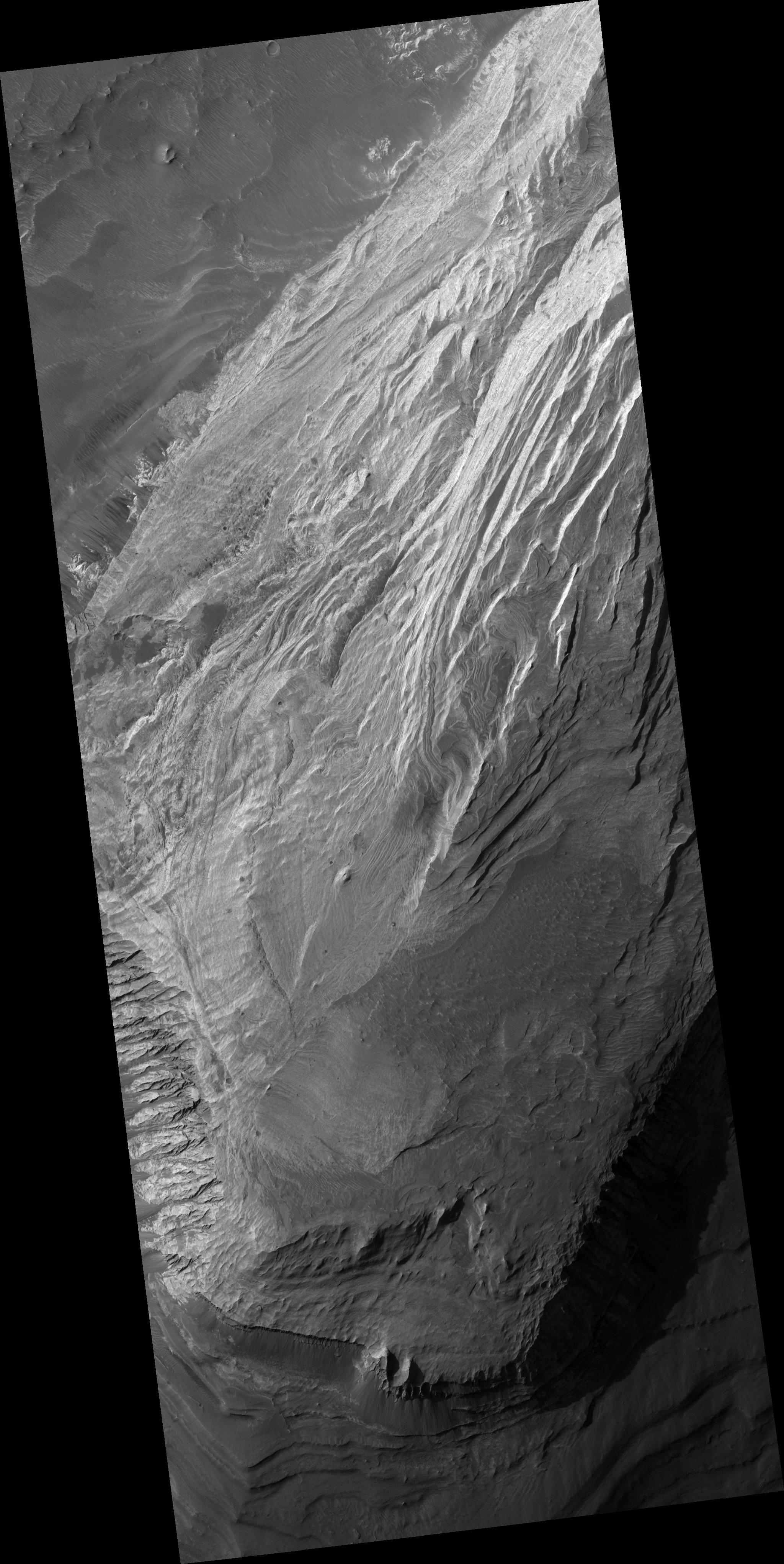
This image shows bright layered deposits near the junction of Coprates Chasma and Melas Chasma, part of Valles Marineris. The outcrop shown here is in a wide alcove in the northern wall and forms a broad mound several kilometers wide; dark, wind-blown material covers it in places. Similar light-toned rock occurs in many places in Valles Marineris. An important question is when these materials formed: were they deposited within the troughs after they opened and then eroded, or are they remnants of the wall rock? Analysis of the orientation of the layers using HiRISE images may help scientists answer this question. There are no fresh impact craters preserved on the outcrop surface, suggesting that the layered deposits are being eroded rapidly enough to erase the craters. In many places, the light rocks have regular fractures called joints. Joints are common in rocks on Earth, and HiRISE images show them in many places on Mars as well. These can provide information about the forces which have affected the rock since it formed, which helps unravel the geologic history of this outcrop.
Image PSP_001456_1695 was taken by the High Resolution Imaging Science Experiment (HiRISE) camera onboard the Mars Reconnaissance Orbiter spacecraft on November 17, 2006. The complete image is centered at -10.2 degrees latitude, 291.2 degrees East longitude. The range to the target site was 258.4 km (161.5 miles). At this distance the image scale is 25.9 cm/pixel (with 1 x 1 binning) so objects ~78 cm across are resolved. The image shown here has been map-projected to 25 cm/pixel and north is up. The image was taken at a local Mars time of 3:33 PM and the scene is illuminated from the west with a solar incidence angle of 59 degrees, thus, the sun was about 31 degrees above the horizon. At a solar longitude of 136.9 degrees, the season on Mars is Northern Summer.
NASA's Jet Propulsion Laboratory, a division of the California Institute of Technology in Pasadena, manages the Mars Reconnaissance Orbiter for NASA's Science Mission Directorate, Washington. Lockheed Martin Space Systems, Denver, is the prime contractor for the project and built the spacecraft. The High Resolution Imaging Science Experiment is operated by the University of Arizona, Tucson, and the instrument was built by Ball Aerospace and Technology Corp., Boulder, Colo.
