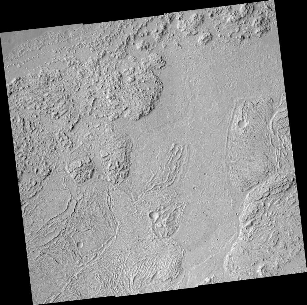
This HiRISE image shows a wonderfully complex surface on the floor of this ancient flood-carved canyon. In this area, the water flowed from the west to the east. However, the floor does not show the kinds of landforms scientist expect from flood erosion. Instead, the floor of the valley has been covered, sometime after the flood, by some kind of flow with giant ridged plates. Some of the plates are more than a kilometer (0.6 miles) across. The ridges appear to have formed when the solid crust on the flow was crumpled during flow. The plates are pieces of the crust that had rafted apart. Very large lava flows can produce this kind of surface, but ice and frozen mud are also capable of forming similar features.
Image PSP_001456_2010 was taken by the High Resolution Imaging Science Experiment (HiRISE) camera onboard the Mars Reconnaissance Orbiter spacecraft on November 17, 2006. The complete image is centered at 20.7 degrees latitude, 287.2 degrees East longitude. The range to the target site was 280.3 km (175.2 miles). At this distance the image scale ranges from 28.0 cm/pixel (with 1 x 1 binning) to 56.1 cm/pixel (with 2 x 2 binning). The image shown here has been map-projected to 25 cm/pixel and north is up. The image was taken at a local Mars time of 3:27 PM and the scene is illuminated from the west with a solar incidence angle of 49 degrees, thus the sun was about 41 degrees above the horizon. At a solar longitude of 136.9 degrees, the season on Mars is Northern Summer.
NASA's Jet Propulsion Laboratory, a division of the California Institute of Technology in Pasadena, manages the Mars Reconnaissance Orbiter for NASA's Science Mission Directorate, Washington. Lockheed Martin Space Systems, Denver, is the prime contractor for the project and built the spacecraft. The High Resolution Imaging Science Experiment is operated by the University of Arizona, Tucson, and the instrument was built by Ball Aerospace and Technology Corp., Boulder, Colo.