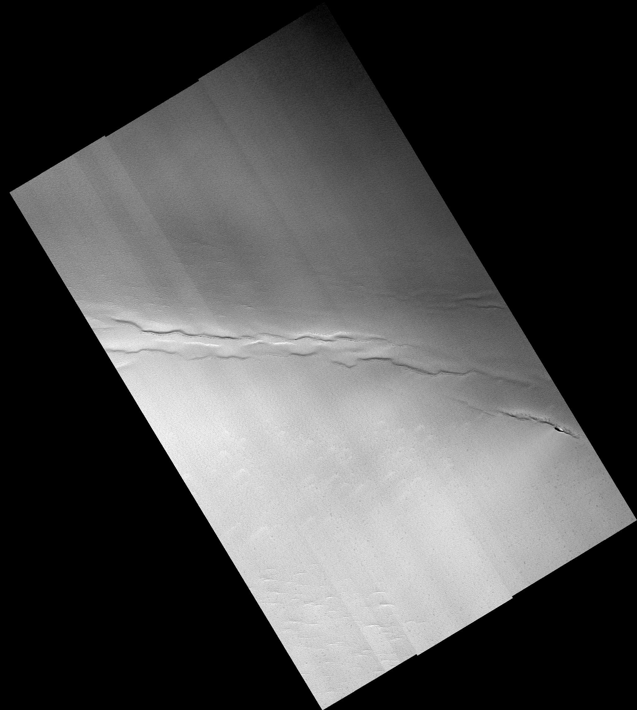
This full HiRISE image shows faults and pits in the north polar residual cap that have not been previously recognized. The faults and depressions between them are similar to features seen on Earth where the crust is being pulled apart. Such tectonic extension must have occurred very recently, as there the north polar residual cap is very young, as indicated by the paucity of impact craters on its surface. Alternatively, the faults and pits may be caused by collapse due to removal of material beneath the surface. The pits are aligned along the faults, either because material has drained into the subsurface along the faults or because gas has escaped from the subsurface through them.
Image PSP_001513_2650 was taken by the High Resolution Imaging Science Experiment (HiRISE) camera onboard the Mars Reconnaissance Orbiter spacecraft on November 22, 2006. The complete image is centered at 85.1 degrees latitude, 137.6 degrees East longitude. The range to the target site was 319.9 km (199.9 miles). At this distance the image scale ranges from 32.0 cm/pixel (with 1 x 1 binning) to 64.0 cm/pixel (with 2 x 2 binning). The image shown here has been map-projected to 25 cm/pixel. The image was taken at a local Mars time of 1:29 PM and the scene is illuminated from the west with a solar incidence angle of 69 degrees, thus the sun was about 21 degrees above the horizon. At a solar longitude of 139.1 degrees, the season on Mars is Northern Summer.
NASA's Jet Propulsion Laboratory, a division of the California Institute of Technology in Pasadena, manages the Mars Reconnaissance Orbiter for NASA's Science Mission Directorate, Washington. Lockheed Martin Space Systems, Denver, is the prime contractor for the project and built the spacecraft. The High Resolution Imaging Science Experiment is operated by the University of Arizona, Tucson, and the instrument was built by Ball Aerospace and Technology Corp., Boulder, Colo.
